Link toTravelogue of our Alaska trip
Link toE-Mail travelogues for Alaska trip
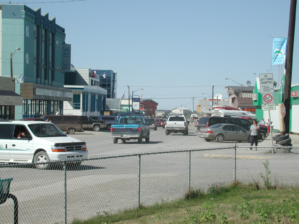
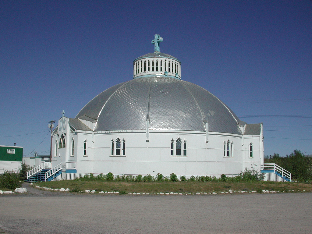
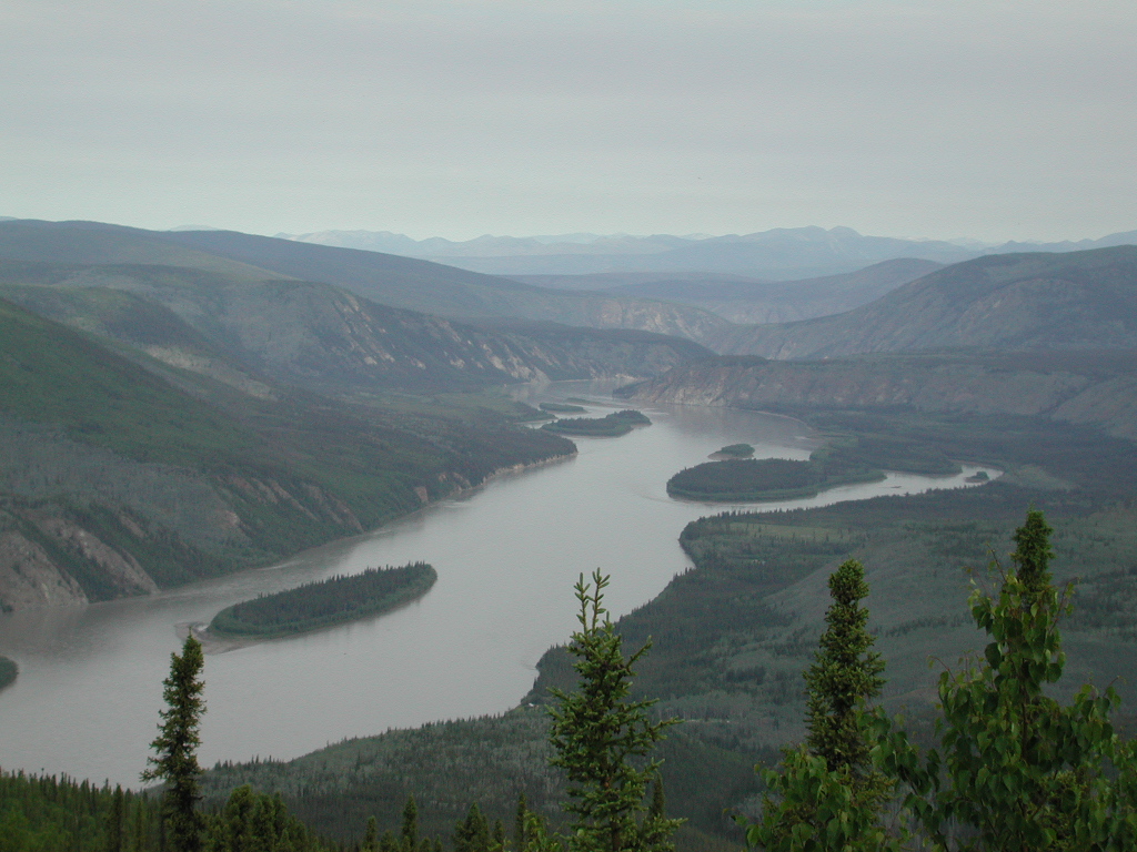
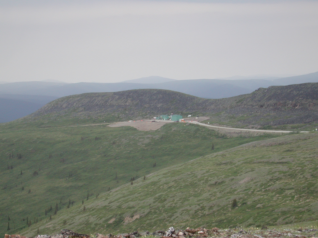
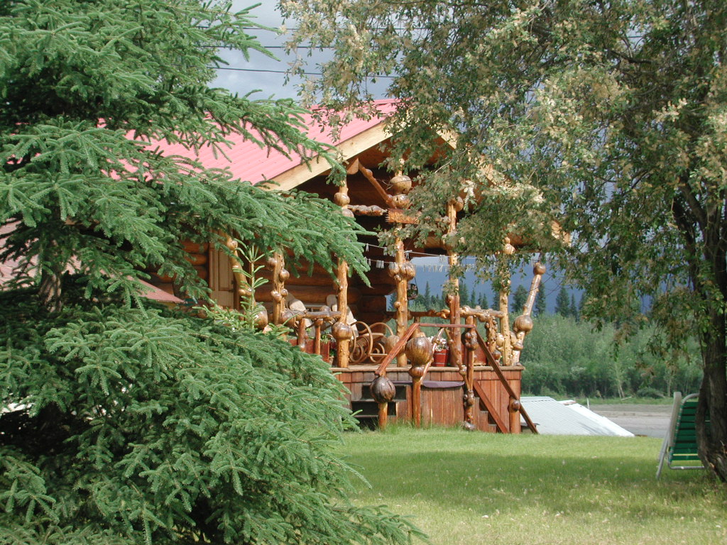
I have selected what I feel are some representative pictures of our travels. If there is something you would like to see let me know and I will see if I have a picture and can send it to you direct. If you have any questions feel free to E-mail and I will got back to you but it may take awhile as I don't check this e-mail address very often.
Our plan is to see as much scenery as we can, cover all the main roads in Alaska, get the Artic Circle and be able to see the sun for 24 hours straight, stay away from the tourist places, stay in provincial and state campgrounds or on private property where we could get permission. Our other objective was to meet as many locals as we could, talk to them and get on some back roads.
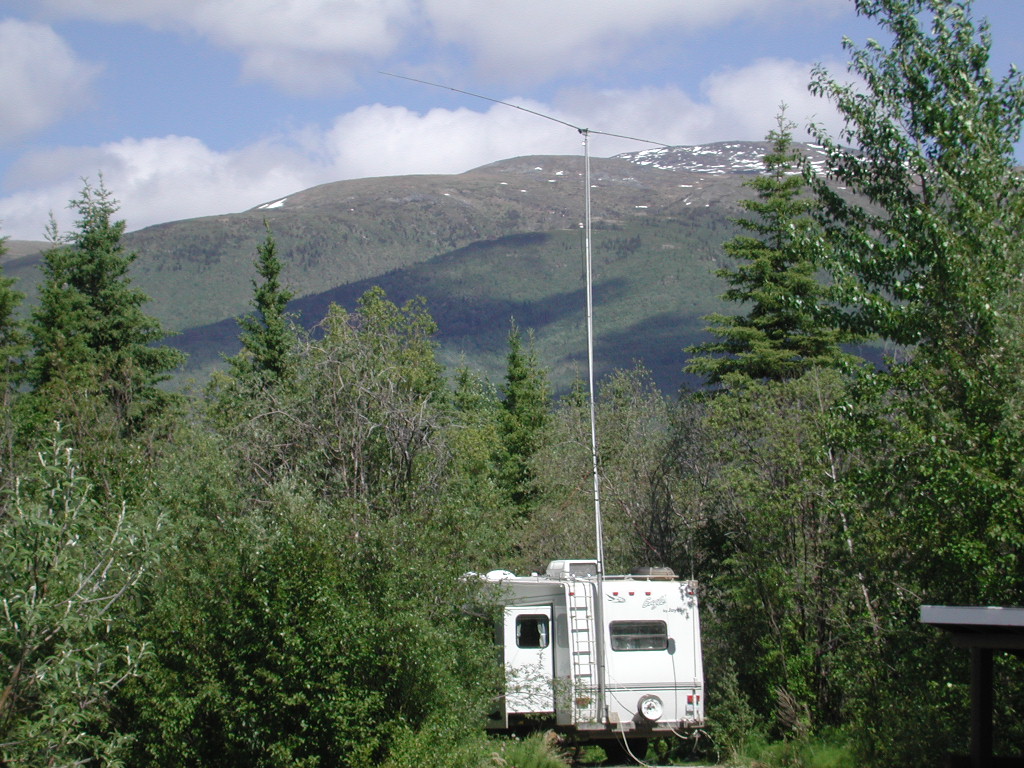
Before we get into the pictues and travelogue I want to discuss our travel plans. We decided on a 5th wheel and diesel pickup, a Ford F-350. You can find more on this in our Traveling Rig link. We wanted to be self contained so we could park any where we wanted for long periods of time and we wanted to be able to make amateur radio contacts with our friends while we traveled and send and recieve E-mail while on the road. After looking at finding modem connections, Pocket Mail, Satellite we decided on using what is called Winlink 2000 which uses amateur radio Pactor a digital communication which links up with the Internet. It has been working out great. To make this all possible I have a battery bank of 16 six volt deep cycle batteries in series parallel to give me a large capacity at 12 VDC that I charge with the second alternator on the F-350. Again for pictues and more details so link I just mentioned.
Now for the travelogue! DAY 1-June 11 Monday
Got off about 1:00 pm, weighed at Cenex scale and was a little heavy but not to bad. We stopped at Mitchell and Got a couple of caps from our friends Jack and Shirly Duxbury as I thought I had left all but one good cap home but it later turned out I had a work cap. Anyway I now have plenty of caps
Got to Redfield, SD about 5 pm. and Mike WG0F was on .46 and talked us in. Mike and Linda were great fun to visit with. We talked about all sorts of things and we looked at our travel rig and then at theirs which was very nice. Their truck is just like ours except a gas engine and crew cab. They need to be back home by August 18th for a class reunion at Zell.
We left Mike and Linda about 7:00 pm. and got ahold of Arliss W7XU on .125 on 6 meters and moved to .157. I realized I had left my grid square map at his place after the contest. Randy KA0ZEE from Aberdeen broke in and offered to bring me an extra one he had. He directed us around the detour for hwy 281 to Walmart where he met us with the map. We had a nice visit with Randy. We spend a nice quiet night and just used the two coach batteries and had plenty of power. We got some liquid paper for fixing mistakes in the log and a gallon of milk at Walmart
DAY 2 - June 12 Tuesday
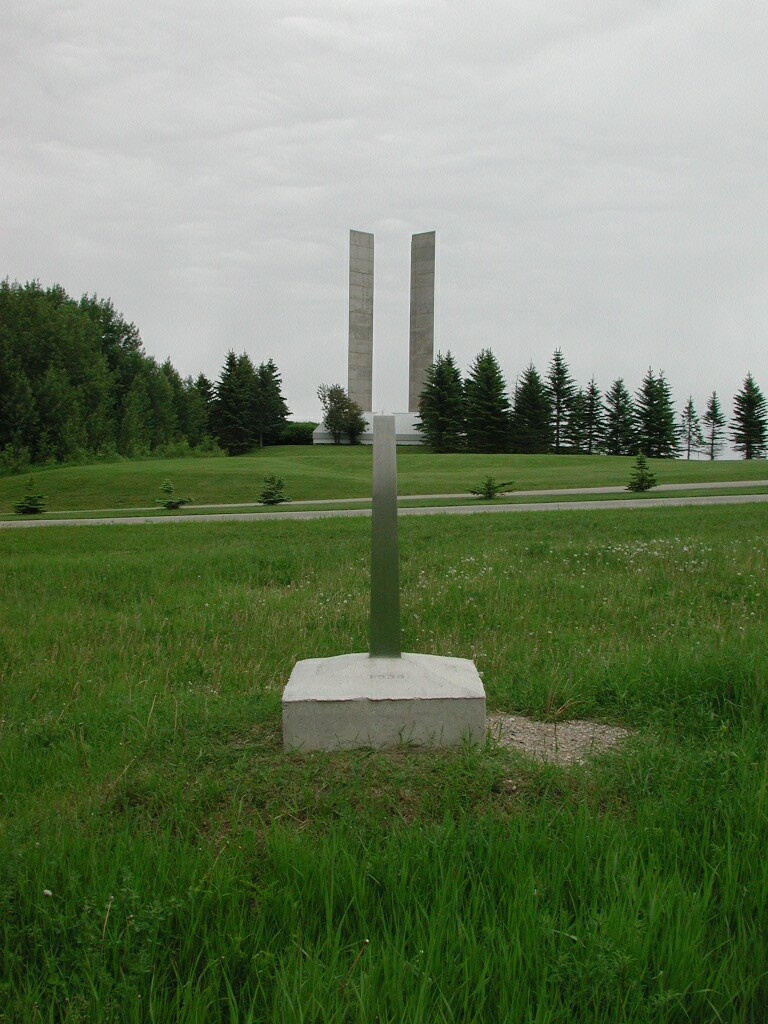
We arrived at the Peace Gardens about 1 pm. They were just putting out the flowers. Lots of changes since we were there in 1972. It certainly would be better to visit in July or August.
The first 20 meter sked which I regularly maketo keep in contact and a way for people to get ahold of us on the road was S-9 with N6RL and N5PZ. Arliss W7XU also came up and I told him I would E-mail if possible and also got his full designator EN13LM to use goto on the GPS to get distance and direction back home. This has worked great!
The customs was a breeze, where we were headed, where we were from, did we have any tobbaco or alcohol. Any firearms and was anybody else with us back in the trailer. That was it. Probably took about 1 minute.
We put on about 362 miles from Aberdeen SD to Brandon, MB. We could not park in the Walmart lot which was right on HWY 10 but went across the street to Canadian tire where some trucks were parked which worked fine.
DAY 3 June 13 Wednesday
Riding Mountain national park had real mountains and some nice lakes. Sign got me in the wrong lane to enter the park and has a hard time getting the trailer so it would go thru a real narrow lane with curbs. Lesson when you think you can not make it stop right away and back up while you have room.
Mixed trees and small grain farming until north of Cowan then got more wooded. We put air in a trailer tire that had a
slow leak at The Pas. We made the 20 meter sked and conditions were good with N5PZ and W7LFB. We made a meteor sked with
Arliss and Holly abot 20 km out from Flin Flon. Edith got directions to the tourist information and camping area from a
conservation officer how stopped at the park we were in. We found the park right away and parked in a pull thru but after
taking a walk we seen where the unserviced area was so we moved. It turned out no one was around and no box to pay so we
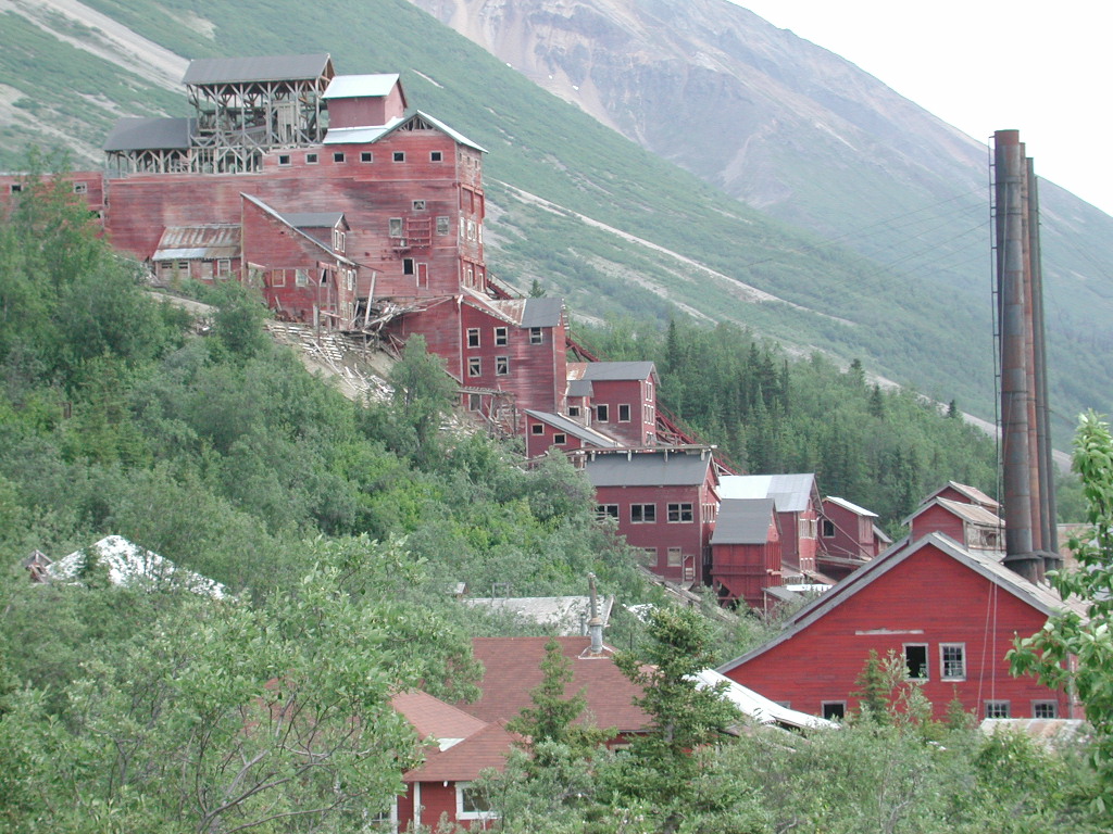
just left. The Flin Flon area is a lot like the Black Hills except there are hills and not mountains. There is a lake
in the center of town and a very, very tall smoke stack at a big mine in town.

DAY 4 June 14 Thursday
The visitors center in Creighton was closed and would not open until 9 a.m so we headed out and missed our road but the
GPS showed us so we found out about it after only a couple of blocks so we got right back on course. Rocks and trees and
we headed for Jan Lake and again hills, not mountains. I got some information from the store at Jan Lake on canoeing and
license information. We spent all day going north to Pelican Narrows and Sandy Bay which are Indian communities. It is
long drive, lot of wash boards, curves and steep hills. We made a great meteor scatter contact with Holly and Arliss
just south of Sandy Bay. Probably the loudest of the trip. When we were near Jan Lake we got a rock in the disk brake
and it made a horrible scretching sound. We picked up the trailer at Jan Lake and headed west. We found diesel and had
a nice conversation with a couple from southern SK, north of Minot. We then took the gravel to La Ronge which was good
except they had put new gravel on soft spots so it really pulled when you hit those spots so it was absolutely critical
to not go to fast. We seen very, very little traffic. We stopped at the tourist information center in La Ronge just as
they were closing and got a little idea on camping areas north toward Missinipee. It turned to gravel and started raining
and the gravel was loose with lots of rocks. Edith was tired and we could not find a camp ground. We ended up going a
lot farther north than planned and finally came to McVay Lake. It was not set up for 30 foot trailers. I managed to get
turned aroiund in the parking lot and we set up for the night. Again we left early and did not pay since we just stayed
in the parking lot. We talked to Ole and Floyd at 6 pm and they had decent signals. No one else was on.

DAY 5 June 15 Friday
We were up early and pulled out and headed north to Missinippe which was about 20 km away. We soon found a spot on a pull off and dropped of the trailer and headed on. We checked out Missinippe, got diesel fuel aad talked to Leo a local store owner and got great info for a future fishing trip with my sons. We then crossed the Church Hill River and Otter Rapids and checked out Otter Rapids camp ground and Devil Lake. We then went back to Missinippe and found the Church Hill River Canoe Outfitter Rick and got lots of good fishing spots and route info and islands to camp on. We then headed south back to La Ronge. We stopped where we dropped the trailer and I spent a couple of hours working on arranging things in the back of the pickup based on our experience so far and changed the low tire on the 5th. Lots of fisherman traveling the road. It is about 32 miles gravel and 16 miles oil. There was a dump station at Missinippe and the prices in the store for lures was not that bad. At La Ronge we got the tire fixed. It was quick but did cost $16.95 Canadian. We then headed south on Hwy 2 with the wind at our backs and the mileage was looking good. We took the gravel cut across above Prince Albert Park. It was tough. First new loose gavel, then soft spots, then good for aways and then muddy, bad soft spots and for 11 miles also very narrow. The last part had huge sink holes. One had to go slow as it would really pull. I suppose I average 35 mph. Just before the oil to Green Lake we used a pull off for the meteor sked. We decided to spend the night. We leveled the trailer on 2 blocks and Edith discovered a dragging wire. It turned out to be an electric brake wire that Jayco had not lashed up adequately. I tried to solder the one broken wire but it would not take solder so we used a wire nut and then rubber taped and black taped and then taped it up and used wire ties. We added some wire tires on the wires right at the brake drums and checked for any other possible problems. The misquitoes chewed on me pretty good under the trailer. We set up for the night and found some dust the came in the slide out. We had to start the generator for the vaccum as it did not like the inverter. It gets dark about 10:45 local. Seemed to be some light all night long.
DAY 6-JUNE 16 Saturday
It rained a lot of the way today. From Green Lake, SK on we got out of solid trees and got into cattle county and some farming in open areas. Meadow Lake is a nice town with lots cattle, horses and farming and logging. We seen a large pulp mill. Next year when going to eastern Canada we need to tour one of these. West of here into AB was similiar with heavy trees from time to time but most of the way open areas. In AB we started to see oil wells. Cold Lake, AB is a very nice town with lots of stores. One could see to the north as we traveled that it appeared to be all trees. The soil looked very good and a town in Ab is called Good Soil. We dumped at Ababisca, AB and talked to a nice lady in the tourism office who said Lawrence Lake was right along hwy 2. There was a motor cycle rally just south and we thought the campground might be full but it was not. It was a hard place to back in but we were up on the hill and by ourselves.
Finally on the third night of trying via amateur radio I got E-mail to send. Apparently I was not posting the messages correctly and therefore they would not automatically send. I also learned again that one has to put a different subject for each e-mail. I sent out a lot of e-mails and found about about 4 stations that had good signals on 20 meters to connect with.
DAY 7 - June 17 Sunday
We went about 280 miles today and had good roads and wx across AB. We seen a helicoptor air lifting forest fire fighters from a staging area to fight a fire. We drove thru a huge burned area that happened a couple of weeks ago before we got to Slave Lake, AB After that we hit what is called the high plains area which had lots of open areas that were farmed growing small grain and canola. We also seen a lot of forest product related plants.
We seen a kids school bus shed that was a small grain elevator and the slogan on it was Elevate Your Knowledge. It was neat! Today we tried an hour at noon with Arliss and Holly and I got calls but Arliss could not copy me. After that we had a good chat with Arliss and Holly and also Curt K7BI called in from Dave cabin. We were about 1275 miles so it is just getting out to far. We will try tomorrow and is likely our last meteor scatter sked until the way home Hopefully we can get some sporadic E or Auroral E. When I got gas in Peace River I had trouble with the curb and had to back up so need to be more observant in watching for curbs and not turning to quickly.
We spent the night at Twin Lakes Provincial CG north of Manning on the Mackenzie HWY. We met some locals and visited with them about 90 minutes and they answered a lot of our questions and pointed out things to be sure and see in the NWT. They had spent quite a bit of time stateside. It was a Mom and Dad and their son and wife who were in their 40.s. We had great success using W9GSS for WL2K and got several E mails and sent several Some people are using reply and I have to get them to erase the text they received if they are going to do this.
The satellite system would not work and we assume we were looking at 22 degrees thru the trees and the signal must be blocked. The mosquitoes were pretty bad. It cost $16 Canadian for the camping spot. It was $11 at Lawrence Lake. We did have a nice high location and got backed in quite quickly. The key seems to be to pull ahead plenty before backing so there is time for the trailer to come around. The tough part is to have room for the front of the truck.
Day 8 Monday June 18
We seen Keg River where the people we met the previous day taught school. We put on 600 miles today. High Level was a
fuel stop and we seen the northern most grain elevator. From there on the farm ground was gone and it was trees. We
filled up at Indian Cabins in AB just before NWT to get the last cheaper fuel. Diesel is in the 90 cent per liter range
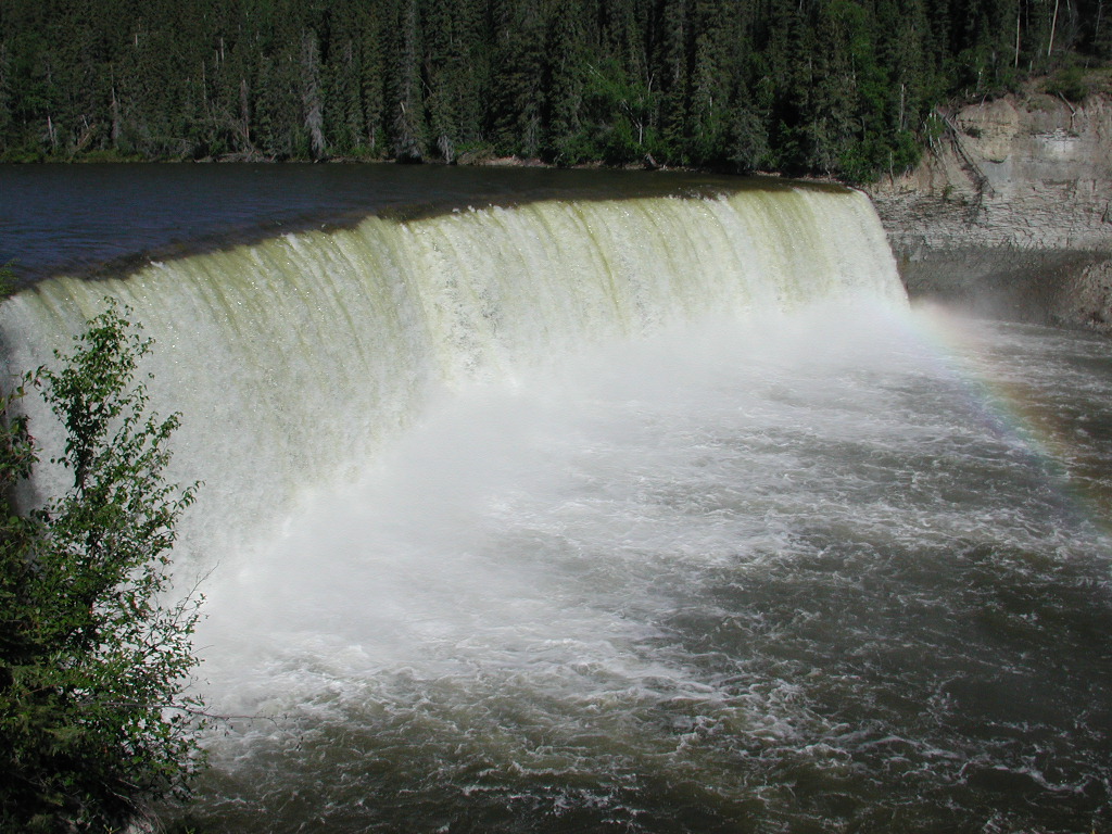
in the NWT so far. We then seen Alexander Falls and Louise Falls on the Hay River. They were very impressive and had
excellent viewing platforms and tails.

We then turned on Hwy 5 to Hay River at Enterprise and headed for Wood Buffalo National Park. We dropped the trailer of
at Polar Bear Lake at what appears to be the Polar Bear Recreation park. Nobody is around so apparently it is a week end
thing or just certain times. They charge $5 a night when someone is around to collect. We then headed for Wood Buffalo
park a;nd Fort Smith which is about 140 miles. We seen a sink hole, where the Whooping Crane and sandhill crane nest and
Little Buffalo River Falls and the Salt Plains. We went on to Fort Smith and bought our highest diesel fuel of the trip
at 92.9 cents per liter. On the way back we seen buffalo and a bear and some Sandhill Crane.

It is 10:54 and the sun is still up. It should be light until close to Midnight tonight, maybe later. A few sprinkles today but mostly sunny with a slight breeze. The mosquitoes were definitely the worst of the trip today.
Day 9 Tuesday June 19
We spent a terrible night at Polar Bear Lake with mosquitoes getting into the camper. We slept very little. They seemed to be getting in the AC ducts which we taped and also in the slides. We finally gave up after only a couple of hours sleep and headed out. We drove to Enterprise and had to wait for a place to open for diesel so we slept in the pickup. the bugs were terrible outside. Once we got fuel we continued on the Mackenzie and seen the Macnally Creek falls and helped a couple from Alberta with a jump as their battery was dead. We then went to the Hart Fire Tower and seen a large area that had sank and from there to Lady Evelyn Falls which was quite large. We then headed up the Yellow Knife road and crossed the Mackenzie River on the ferry. It is neat how you pull on one end and drive of the other end when you get across. The ferry's only need about 5 foot of water and have 4 screws, two on each end and have seven diesel motors available. We seen the winter road to the ice bridge. The first part to Yellow Knife is oiled but does get real up and down the last 40 miles. The last 60 miles is gravel with construction and a lot of breakujps. We got in about 5:30 pm local and found Walmart and loaded up on bug stuff. We had a nice visit with Rodd the Manager who said they were the northern most Walmart and drew us a map of the town and suggested things to do. We talked about prices and winter delivery problems and that there are now Super Walmarts in Canada.We then toured Yellow Knife and the Ingmann Trail. It is a nice town, we went to Igloo hill, the docks, the Wildcat Caf� and was impressed with the multi-stored buildings and rich history. There are 600.000 people who fly in and out a year. We had a great nights sleep and no bug problems. Future reference is to always carry house hold bug spray in case the camper fills up with misquitoes! There were a couple of campers from AZ in the lot.

We headed out of Yellow Knife and took our time on the gravel and noted the markers pretty well showed the bad spots on the gravel. On the oil we went slower and had less trouble with the up and down spots. We got by OK with the road repair and chip rock. So far no cracks but we are getting the trailer dirtier all the time from the roads and the dust control water making it almost muddy some times. We made it back to the Mackenzie Hwy turn off about noon and had dinner at a turn off by a winter survivor cabin. There were a lot of big flies just like yesterday on the way up to Yellow Knife. We then seen Sambaa Deh falls which were very nice. A person got to close and fell of in recent years so they really stressed staying back. The road was not to bad for a gravel road.
We then got on the Laird Hwy and got to Blackstone Provincial park and got water, dumped and washed the camper and pickup.
The manager let us use the hose with the water pressure. Fancy bathrooms, all stainless steel. I tried to download my
E Mail but only got some of the messages as the band was about closed. We did our best at mosquito proofing the 5th wheel.
We got the slides as tight as we could. The out position is the most bug proof. We found we needed to put in foam at the
bottom corners as it is open to the outside. We then put clothes, etc over these spots so the can't get in. We did the
same in the bedroom. About the only place they could get in is along the top of the slide and if this starts to happen we
will have to seal those places with rags or tape. We also have citranella we can burn and household insect spray. The
mosquitoes don't seem real thick so we should be OK. We will check the E-mail again in the morning and also view the
Laird River for the observation point and head for the Alaskan Hwy. Since it will be crowed and I want to do the Field Day
Amateur Radio contest we will likely go to Watson Lake tomorrow(Thurs. June 21) and then Friday, June 22) head up Campbell
HWY and find a spot for FD and get set up on Friday afernoon and Saturday morning June 23 and operate Saturday afternoon
and Sunday. On Monday June 25 we will head for the Dempster Hwy. That will give us 6 days left in June and definitely
should be in AK by our target of July 1-4th and can head south to Anchorage.
DAY 11 JUNE 21 THURSDAY
We have paid three nights so far, Lawrence Lake in Ab, Twin Lakes in AB, and Blackstone in NWT. Stayed free, Walmart-Aberdeen, Canadian Tire, Brandon, MB, Flin Flon Tourist Park, McKay Lake, south of La Ronge, SK, pull off by Green Lakes, SK, Walmart at Yellow Knife, Laird Hot Springs, BC at Laird Lodge, tonight free. Started the day with a nice view of the Laird River from the BlackStone Provincial CG in NWT. The mosquitoes were bad but our plans for keeping them out of the 5th seems to be working. The gravel road deteriated rapidly and it was muddy, chuck holes, soft spots and rocky all day long. It was real rocky and rough in BC but got better as we got closer to the Alaska HWY.
The scenery on the Alaska HWY was great with huge mountains. Mucho Lake was very pretty! Took lots of nice pictures. I
had good success with KB6YNO, W9GSS. At noon used KF6NPC. I sent one message to Ole to relay. I worked on e-mail
addresses and will have to check my brief case for a few I am missing! I talked to KL7HF our friend Del in Anchorage
this morning again so keeping him posted.

Day 12 JUNE 22 FRIDAY
Laird Hot Springs was even better than advertised. It has a long board walk out to the two developed springs. It is
free and we got there early so we got in the lot rather than the overflow lot across the road which was full when we left.
They have changing rooms and lockers which no body used. We had a nice visit with a couple from BC who just retired from a
pulp mill. The upper part of the spring is very hot in the Alpha pool. The top of the water is hot than down below. They
have under water benches to sit on. Farther on is the beta pool which is nice an warm but not so hot. It is deep and you
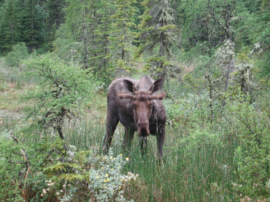
have to swim as it is over your head. I also got pictures of two moose. One was very close. We then headed down the the
road and the AK net was on. I had Del KL7HF our Anchoragde friend move up when he checked in and we had a great qso with
loud signals. The best yet! We then pushed on to Watson Lake and seen lots of nice scenery. We did see Smith Falls which
was nice. The road was narrow and if we would of met another RV it would not of been good. We got to Watson Lake about
noon and stopped at the tourist info building and got plenty of info and picked up 2 YT camping permits. We also went to
the bank and exachanged US for Canadian at 1.497 so apparently the C dollar is a little stronger. They said there was no
sur charge. We seen the sign post forest in passing and will spend more time on the way home.
We then headed up the Campbell Hwy which was not so bad for gravel but it was narrow, many curves and steep in places. There were spots that were rough. About 60% of the way I found out I had lost a tire. It had been awhile as the tire was gone and the rim ruined and the brake wires to that wheel were broke. It started to rain while making the repairs but fortunately not very much. It rained hard off and on today. I had some question as to which was the positive wire but looked at the other wheel and put this one the same. It seems to be OK. We then pushed on looking for a FD spot to operate and trying to get into a Yukon RPT which we never did get into. We went to Ross River but everything was closed for fuel. We seen the walkover bridge and small ferry over the Pelly River. We then headed on and decided to skep Farro as it was getting late. We were getting low on fuel. We finally found a YT CG called Drurey at Salmon Lake and parked. It turned out to be a good choice.
Day 13 June 23 Saturday
My birthday and I needed to get set up for FD. Things actually fell into place quite well despite running out of time
before leaving. I did have to make some jumpers and longer runs of coax. I had a dipole on 40, the rotary dipole on 20
and the Bugcatcher on the back of the trailer, for 15 the BugCatcher on the pickup and made a 10 meter dipole and put up
the 6 meter beam. Writelog worked real well. I did have to program the RTTY messages which with the browse feature was
not bad. I started out calling CQ but found I was not strong enough being so far away from everyione so I had to search
and pounce. I made over 200 contacts. The toughest area was the northeast by far. On Saturday 15 was pretty good and I
probably would of done better if I would of had the other mast up and a 15 meter dipole. I made a few RTTY contacts on 20
meters but the activity on rtty was very low. I could really hear well but would call stations that had good strength and
they did not have a clue I was calling. It seemed like toward evening and Sunday I was being heard better, maybe the qrm
level had dropped some stateside so they could hear better. The inverter puts out quite a bit of noise so I need to get
that situation fixed for operating and also using Winlink. It did not hurt much in FD here as the stations seemed to have
to be pretty strong for me to work. The old adage if you can hear them you can work them is garbage!
Day 14 June 24 Sunday
I did get my E mail and sent one out via Ole to the gang. I connect with a new station at San Diego. It was a neat experience but would be better in a contest where the operators were more experienced and VY1 was chased for a multiplier. I quit at about 2000z as the activity had dropped to nil. It took about one hour to tear down the FD stuff and another 30 minutes to get the 5th ready to go I had to put in 5 gal of diesel from our emergency container in the back of the pickup. I did get the mast arranged better in the back of the pickup and need to make some notes on how they are so I have the system documented.
We then headed off along Salmon Lake which is about 8 miles long. On the 20 sked we talked to Roger, Jack and Floyd. Roger had a good signal for the first 30 minutes. We seen the site of a steam boat disaster on the Yukon River at Eagles Nest. It was our first look at the Yukon and it is impressive and looks fairly muddy. We got to the Klondike HWY and went south a little to Carmack and got fuel and 5 camping permits and headed north. We missed the 5 finger rapids as we did not realize that was what the turn out was for until a bit later when we found it in the Milepost. We stopped at Pelly Crossing where we found a free campground just south of the bridge over the Pelly River. This is the same river we were by at Ross City. We met a couple Peter and Shirley from BC. He retired from Shell. They showed us how to make Mountain Pies which are made with special holders made of cast iron with long handles. The holders are just the correct size to put two slices of bread in and you can put what ever you want on the bread for meat, onions, salsa, vegges, eggs, etc. also pie mix and other sweet things. They come out so you can hold them and eat like a sandwich or put on a plate and eat like a pie. We had strawberries for dessert and the talked about their AK trip, the Top of the World HWY was the best they said.
They said the people at the store here at Pelly Crossing said you could stay here for free. All along the Yukon and Pelly River we seen lots of canoe activity. At Carmack we seen an RV with a canoe on. The had anchored wood to the roof and then put racks on the wood and the canoe on the racks.
DAY 15 June 25 Monday
We changed oil on the pickup as we have came 5000 miles. We are going to bypass Keno as we are not into museums that much
and it is partly gravel and are anxious to get started up the Dempster Hwy and get above the Arctic Circle shortly after
the summer solice. We got on the road about 9:30 a.m. local. We were able to buy a tire at the Dempster turnoff but not
rim. They would not take our used oil. We put a little air in a couple of tires and headed off. It was a beautiful spot,
one of the highest on the Dempster, looking down the valley to stateside with mountains at the end of the valley. There
was wide shallow run off looking a foot or two deep and 100 years wide with snow in part of it which was caving of into the
water. When the breeze blew a sweater felt good but it was very nice out of the wind. I had good success with E Mail with
KA6IQA connection. We then drove on to the continental divide overlooking the Olgivie River and stayed the night at the
pull off.
Day 16 June 26 Tuesday
We got started about 8:30 and soon the road got real rough and rocky. I stopped to check things after we had went about
70 miles and found we had a broken leaf spring on the passenger side rear wheel of the 5th wheel which let the two wheels
come together and they were rujbbing. The tires were warm but not hot! I drove a little farther to see if they would
shift apart but they did not and they were starting to get much warmer! I thing got the inspiration to jack it up and wedge
a big block we had between what was left of the leaf spring and the frame. I hooked a rope to it so if it came out we
would not lose it. I also noted the front of the spring was bent but not broken. However it cause the tires to be closer
together also. We tried it and it worked but the weight cut into the wood block and the tires got real close but did not
touch. We calculated it was about 33 miles to Eagle Plains so we drove slowly and checked things often. We made it OK and
what a blessing they could get right on it and the had leaf springs. The question was did they have the right one. It was
quite a job to get off but the did and they had a replacement. I was also quite a job getting it back together. Definitely
not a roadside job!!! They treated us very well only charging $50 Canadian for the spring and $65 labor and they had two
fellows working on it most of the time.. We headed on for Inuvik and stopped at the Arctic Circle sign where we met some
people from WI and we took their picture and the took ours! We were visiting and he noticed my trailer tire was going flat.
We had a tough time changing it as we could not get the trailer high enough to get the spare on. A couple stopped and had
some blocks and helped us and by using their blocks and the stabilizer jacks we managed to get it. We need to have more
blocks in the pickup in the future and we need a stand jack to support the trailer so one can reset the jack. We also need
a piece of metal to lay on the frame to jack against rather than the wood as the jack cuts into the wood to much. We then
headed off again and decided to stay at Rock River CG YT and then just drive the pickup to Inuvik tomorrow and then come
back tomorrow afternoon and stay the second night and then head back down the Dempster. We will try and get the tires fixed
and get a rim at Arctic Tires in Inuvik for a safety margin heading back down the Dempster. There is about 100 miles of bad
road we have to go back over from the Arctic Circle to where we camped last night.

Day 17 June 27 Wednesday
We left for Inuvik with the pickup about 6:30 am and found the road got much better at the NWT border. We were surprised at the trees and found out at Inuvik that this is the fartherest North the tree line goes in Canada. It apparently goes farther north because of moderation from the McKenzie Delta. We crossed the Peel River on a ferry and the road go better. We stopped for to see if we could help a couple who lost the drivers side window from a rock when they met a truck. I apparently hit the side mirror and richoched into the window. We then crossed the McKenzie on the ferry. It was 150 feet deep in the middle. We had a nice chat with the barge worker. From here on the road was excellent. We got to Inuvik about 11:00 am and went up the lookout tower. Next the did the western Arctic Visitors center and got our certificate for being above the Arctic Circle. Then we found a couple of ham stations and one, VE7EV wife was home and she got it lined up so we could see him at work. He is in communications and their office is a dewline radar dome they moved and sits on a hill in the middle of town. We had a nice visit with him, he is not very active as the qsl thing go to him. He said they are right under the aurora so it is tough. He called the not being heard but hearing the deaf ear syndrome. He said there Internet connection is via satellite. We then went to the tire shop and got a tire mounted on a flat and bought a used rim, cash deal so the underground market worked here.
We toured the harbor, Igloo church, got some Canadian money after a long wait in the bank. Interesting to see mosquitoes
flying around in the bank. I went to the library and got on the Internet with a Gateway computer, checked my E mail and
sent one but apparently screwed something up as it did not go. We did get some tourist stuff like post cards and a bumper sticker. We then got a Coke and some Ice Cream and headed back, checking out the airport. It is a nice, modern town.
The plumbing is in heated ducts above ground and the housed and building are on pilings due to the perma frost. There were
a lot of radio towers with monopoles and dipoles for commercial communication.
We had a good trip back to the camp site, took a picture of Carmichael Lake and had a good visit with the barge worker. He told us you should never kill a mosquito because millions come to their funeral. We talked to a couple who were bicyleing down to Dawson City, quite a challenge. We hooked up the 5th wheel, mosquitoes were terrible and headed for Eagle Plains. We got to Eagle Plains and finally just parked by the garage and left the slides in. We needed diesel to make it the rest of the way and wanted to check for a tire since they did not have one in Inuvik.
Day 19 June 29 Friday
We spent our first kickback day today since we left on our journey. We got up about 7:45 am, had breakfast and done some
chores around the 5th. I did some things with the computer. We then checked out Bananza Creek, the gold dredging, dredge
# 4 and the original claim called Discovery. We then went up on Dome Hill overlooking the Yukon, Bananze Creek and Dawson
City. It is a nice view. We then toured around Dawson City and watched videos on Dawson, the gold mining and river boats
a the visitor center. We then did laundry, mailed my Mom a card that was hand postmarked and get diesel the highed priced
of the trip at $2.33 a gallon. We also found a place to dump and get drinking water for $1.00 at a RV Park we found out
about at the Visitors Center. The line up for the ferry crossing the Yukon was about 1 mile long. We also looked at the
KENO a rverboat they we restoring and toured the water front. We then headed back to the CG and I put up the dipole, made
the 5 pm sked with Chris and found out by going to the pickup with the 400 watt and dipole really was a lot better than the
100 watts. At 6 pm I talked to Tom, Ozzie and Roger. Signals were down! I sent my e-mail and got most of it connecting
with VE1XZ and KB6YNO/1. We then tore down and headed west. The line to the ferry was way down and took about an hour.
It would of taken 4 or 5 hours this morning. Before getting in line we dumped and got fresh water and also seen the fellow
from WI who Pheasant hunts in SD again. We then headed west toward the Top of the World Road(here it is called Klondike
Loop) and are stopped for the night on a pull off. There is a van here also. Tomorrow we will be in Alaska on the Top of
the World Highway which we have heard fantastic things about the scenery but will need to take it easy as the road is not
the best we are told. We will park and take the pickup to Eagle, AK.

Day 20, June 30 Saturday
We took the Top of the World Hwy this morning. Actually we thought the first part of the drive to Inuvik was prettier
but this was nice and you sure are up high on what I would call a "HOG BACK". It used to be called the Ridge Road. The
first 60% of the road is just full of potholes! A lot of it is patched with gravel spots. The border cross was very easy,
just asked a few of the normal questions. Did not take much more than 1 minute. The road to Chicken is very wash board
like and it is a long, long way down to the bottom of a lot of canyons. It gave Edith quite a thrill looking down 1000's
of feet when I had to pull way over for an on coming car. One big motor home got over on the soft shoulder and put the
wheels in the ditch but fortunately against a bank. We stayed in a RV camp which has no hook ups but it is roomy and we
are off at the end. It only costs $5.00 and Edith paid $5.00 and she can pan gold as long as she wants in the pay dirt
they provide from the mining they are doing on their 50 acres here. There is an old dredge near by. In talking to the
kids they know a couple who are ham operators. She is the Postmaster! The girl is going to ride her bike down and see
if they can give us a call. We also visited Chicken, AK and got some swest shirts and wooden blocks for Gunner. We ate
at a Salmon Bake tonight at the Chicken Caf�. No one was on at 5 pm but at 6 pm is talked to Arliss and Holly who were
leaving for a family get together in Ore. They will be mobile and be back to SD on July 10th. I also talked to Roger,
Bob and Jack. I had up the dipole and used the SGC 500. I had good success with E mail and used KA6IQA and W9GSS.
Tomorrow we will go to Eagle, AK and depending on when we get back we may stay another night here as we are all set up.

Day 21, July 1st, Sunday
Got up about 7 am and got ready for a day trip with just the F-350 to Eagle. Started the moring off talking to Mike AL7OB on 14.292 and found out we could stay in their yard. We can use 147.210 when we get within 50 miles and we can also call 271-3836 to get voice mail. The home phone is 345-6999. He is going to check one more time on the fishing thing on the ocean charter.
I talked to Josea the daughter and she apologized for not getting to the hams place on her bike last night. She said there little girl broke her arm so she was not sure where they were at. When we got back from Eagle I talked to her again and she said the xyl was Robin and sh e was in Fairbanks with the daughter getting pins put in the breaks. Her husband Dick was home and she would ride her bike down tonight. Robin is Postmaster and her call is WL7VP and his is WL7VO.
Josea said her brothers name was Wes. He told me a lot about their gold mining operation and helped Edith pan gold. Their last name is Busby
The road to Eagle is narrower and I think over-all a little worse than to Chicken. We did not see any 5th wheels or big
Class A motor homes. We did see some small Class A and C. The road is very high above the canyons in places and very sharp
corners and impossible to see if someone is coming. We met an AK car on one of these and he was on the wrong side. It was
lenty close, he shot over to his side and I piled on the brakes. He was NOT TENDING TO BUSINESS. On the way back we seen a
van on its side in the shallow creek about 15 feet down. It looked like it just drove off by the tracks. Don't know what
happened. The road to Eagle is very pretty and does have some turn outs. There is a gravel pile just up the road which
likely would work to leave a trailer if we had it to do over. One goes thru a deep valley, then out on top, then thru a
ot of deep valleys, turns then out on top again and then the decent to the Yukon. Eagle looks to be very poor and seems to
depend mainly on the short months of tourist trade and maybe some things to do with the Yukon River. We talked to a girl
and here mother. They came from CA 21 years ago and don't even have a car. They can not get in and out in the winter other
than fly or take the dog sled down the Yukon to Dawson City. Some people use snow machines. They catch a ride to
Fairbanks for dentist, doctor or shop until you drop days sometimes in the summer. They order things via mail and can get
stuff from SAMS, FRY'S, K-MART and FRED MEYER in Fairmbanks via mail. The mail comes by plane and we thing other things
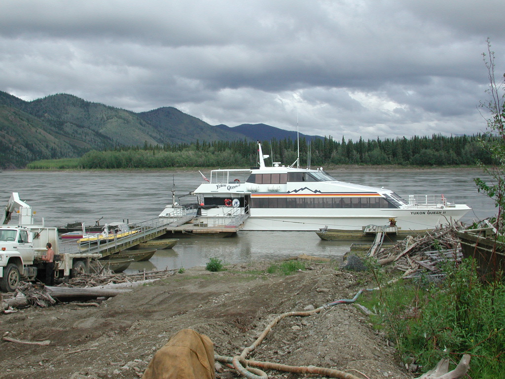
via boat on the Yukon. We seen the Fort Egbert, the court house, the BLM campground, public dock, Yukon Queen tour boat,
4 Holland Alaska tour buses and the hotel on the water front and a great laundry mat. Also a number of planes parked along
the north edge of town. We seen live video of two young falcons in a nest on a cliff at the BLM office. We headed home
which was about a 3.5 hour 100 mile trip. After we got back I talked to Josea and there is still hope in contacting Dick
WL7VP. I had great luck sending and getting E-mail with the dipole and KA6IQA. Had a great supper and paid for another
night. Tomorrow we will head for TOK. I gave a call on .52 and Dick, WL7VO came back and we had about a 45 minute chat.
There daughter broke her arm at a horse show in Palmer and his wife Robin drove her to Fairbanks so they could take her
back to the same doctor when it came time to take the pin out. He has a 60 foot tower and 5 band quad and the same radios
I have and likes digital and does DX and gets on the nets. The Bush Net which he is NCS on Tuesday nights is on 7.093z at
0400z which is 8 pm AK time 7 days a week. Also on 3.920 at 0200z, 6 pm AK time AK Snipers net which is a roll call first. Also 3.933 Motley Group at 0500z 9 pm AK time. I can get SE AK and Canada info for the way out on the
Bush Net on Road condtions. Dick is often around 3.866 in the evenings and does slow scan and msk 16 which handles the
AU better. His e-mail is drhammond@starband.net and I need to send him pictures. His repeater is on 147.09/69 + with no
tone and covers to about mile 9 on the Their last name should be Hammond.Taylor HWY. I need to talk to him from home next winter on meters. Send him an
e-mail.
Day 22, July 2 Monday
Had a nice visit with Mrs. Busby and asked her to thank Josea! She once lived in SD when she was very young. She told us about Caribou Clatters which are messages to people in the bush over the Glennallen radio station on 790 khz. There had been a message from Robin about there daughters broken arm to her worker at the post office that she would have to work today. We listen to Caribou Clatters quite often as it is very interesting and unique!
We Talked to K7FQA on .52 at TOK and got fuel for 1.88 which was the cheapest in a long time. We headed south of Tok on
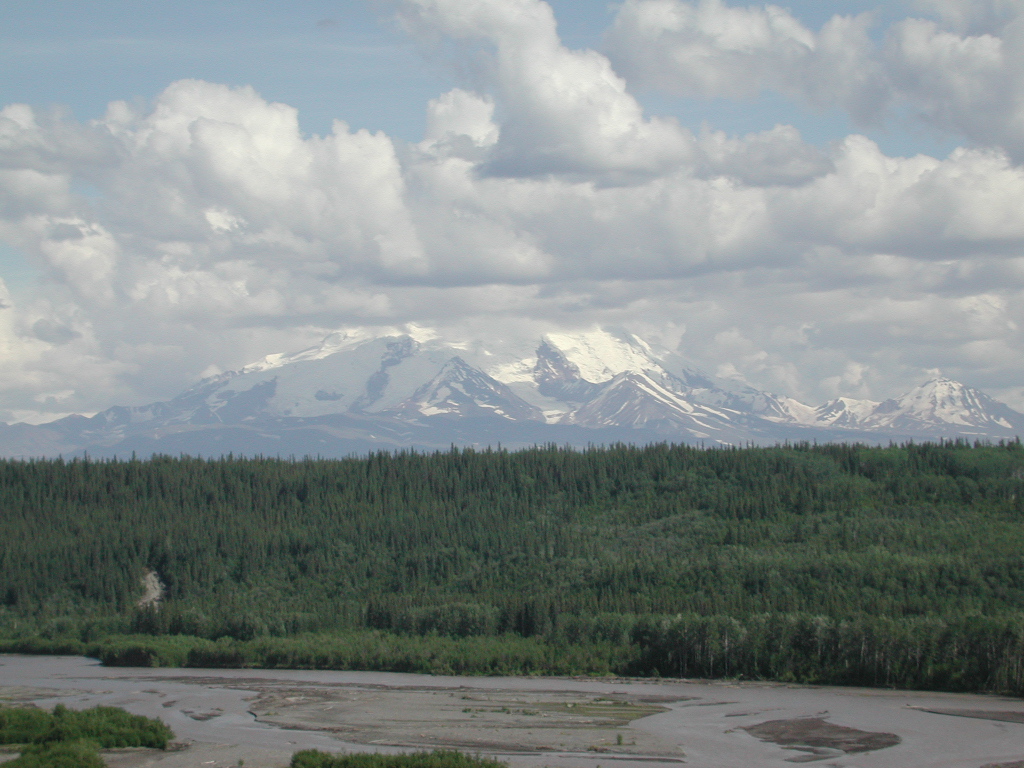
the TOK Cutoff and soon were in the mountains which were very pretty and had snow on. We got some good photo's. I also got my
e-mail real strong from VE1XZ. We then traveled on and seen Mt Drum and Mt Sanford which were huge. We then turned
south toward Valdez at Glennallen on the Richardson Hwy where the roads were all busted up! We seen the pipe line for the
first time. We then turned on the McCarthy road and stopped at Terry and Tammy Van Weyh but a neighbor said she was gone
and he was not around. We headed on torward McCarthy and ended up along the river just north across the bridge over the
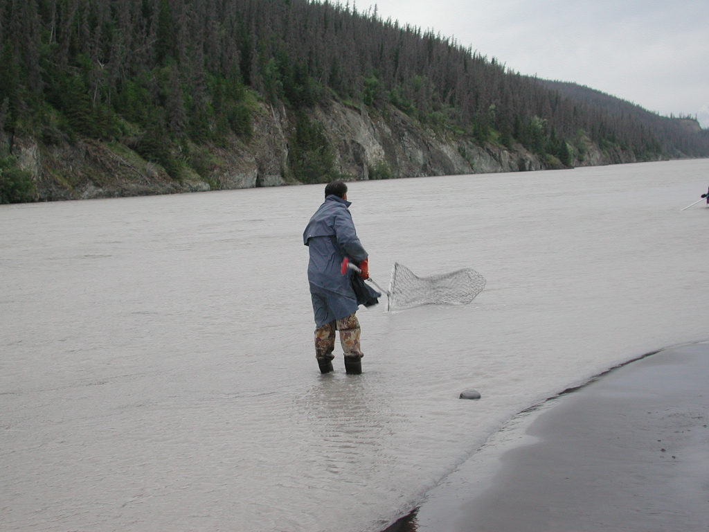
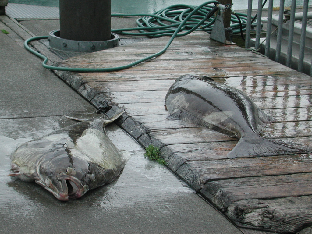
Copper River from Chitina. We parked where all the people are that are running fish wheels and doing dip neting. I spent
most of the night with a fellow we met watching him dip net. He gave us a lot of info on fishing charters and other
fishing info. It was an interesting night. We seen them cut a King and a number of Reds. Above the bridge Ak residents
can do subsistance fishing and cut 500 per family or 250 per person. I got some pictures but a number did not turn out
because it was to dark. I went to bed about 3 am as it does not get dark but it does get pretty dusk! Below the bridge
AK residents can catch 25 fish for personal use. The Game and Fsih of AK watch the runs and if the number is low they
shut the fishing down. They run the best from 11 pm to about 7 am. They do not spawn or can not see in this water but
find a clear stream coming in and spawn in it. It is the one they are born in, called imprinting. He said netting
fish wheel are the only practical way in a silty river like this.


Day 23, July 3, Tuesday
We got up after a windy night, as it really blows hard here. Also streams of water are running into the Copper River
from the north so I had to dig out my overshoes and learned to wade up s tream along a gavel bank so it did not get so deep. We
headed off for McCarthy. The road was terrible. I let some air out of the tires which helped some. The railroad bridge
was impressive and there was some excellent mountain scenery and a great shot of the Copper River. The foot bridge at
McCarthy was impressive as the water was really moving! McCarthy was interesting and the old Kennicott building and glacier
were very interesting. There were miles and miles of gravel shoved up by the glacier. The trip back went a little better
but the last 18 miles are absolutely terrible. It took 4 hours going up and we had to wait 45 minutes for them to put in a
culvert. It took about 3 hours and 15 minutes coming back. Edith read me a lot of the history out of a guide book we got.
After we got back we hooked up and then I went and got some great shots of the fish wheels and of them dip netting. I also
visited with a number of the locals. No radio today as it just did not fit our sked with the road, crowed parking lot and
time constraints. We are going to stay the night along the Copper River just up from the bridge north of Chitina.


Day 24 July 4, Wednesday
Edith got all nervous because it started to rain a little and she was afraid we would wash away and could not sleep so we packed up and moved across the road to a campground and pulled in along the edge of the road and left the slides in and slept. We headed out a little after 7 am and got a picture of Liberty Falls and then stopped and seen Terry Van Wyne and got sodezhme air in our tires and had a good visit. He is moving about 20 miles in the next year or so to a half section of land he bought. His wife Tammy teaches school. He sells a lot of barbeque pigs about 40 pounds and sells feeder pigs. He sell privately and has a waiting list so gets good value added. He gave us some info on Valdez. We then headed south toward Valdez and decided to pull into Blueberry State Park just past Thompson Pass.
We decided to stay and paid the $12 fee with a check out time of 3 pm tomorrow. One can use the area up until 6 pm but
have to pay between 6 pm and 9 am. We then headed to Valdez with just the F-350. We got diesel fuel for 1.78 which was
the cheapest in a long time. We check out the AK Ferry, Fishing from the Valdez Dock, the look out, the harbor where all
the boats were, the beach area, the Sea Otter RV which was $25 to park along the sea with all electricity, dump, fresh water
fill. They had some for tomorrow which she said we likely could get up until noon. We then checked out Miracle Creek Road
buy it required a hike and we did not have time plus it keep getting more cloudy. We then got water for 75 cents a gallon
and a loaf of bread for $1.49 with no sales tax. We then watched a wildlife and pipeline video at Valdez Tours for the
pipeline. We then went on the 2 hour pipeline tour. It cost $17.50 cents each and was well worth it. We seen the floating
and fixed loading berths, the ballast water clean up, vapor fumes removal and adding, the control building which used
microwave towers up the line, the tanks, the pig scrubber that takes out the parafin, and had a great view for a covered
deck overlooking the facility and then where they direct the oil to the berths or tanks and the statue of the workers on
the way out. We then headed back for Blueberry CG in the rain and clouds. We seen Bridal Vale and Horsetail falls. The
Valdez area has high mountains that are green and lush with narrow streams of water coming down the sides and a falls like
fashion. We also seen where the fish at Ellis Point on the way to the pipeline terminal. It appears they are waiting for
the Pink Salmon to run. There is also a fish hatchery there which the salmon return to. This CG is in an Alpine setting
but so far we have had to much rain and clouds to see them much.
Day 25, July 5th, Thursday
We spent the day at Blueberry CG, slept in and did some computer things and decided since it was raining quite hard and very foggy we could not see anything if we headed for Anchorage. I checked the Milepost, got my e-mail and sent some e-mails. On my radio schedule i noticed the mobile amplifier was not working. I tore into that and discovered the keying lead was broken so I fixed that and put the plug back in and it still did not work and the switch was off a band. I finally tipped it up where I could see it better and discovered I had not put the plug on correctly and it was off one slot. Something to watch as I assumed it would have to fit right but that is not the case. The amp then worked for which I am very thankful as it would not of been nice to go the whole rest of the trip without the mobile amplifier. We ran the furnace for the first time as it was about 48 degrees. Fortunately the mosquitoes were not bad. Edith and I got a bunch of water as it appeared to be drinking water. I then noticed the voltage was lower than I thought it should be given how little it had been used. I checked the input fuses and discovered they were blown. I tried putting in another and it immediately blew! I then thought I would see if I could switch it back to the original configuration to see if the alternator was OK and that the diodes in the alternator, etc. were not blown. WRONG THING TO DO! I noticed smoke was coming out from under the hood and out of the battery box. I quickly moved the knife switch back to the center position and that seemed to remove the short but the smoke still kept coming out of the far end of the box. I yelled at Edith to get the fire extingusher as I was concerned the battery box had caught fire. Apparently the smoke was just being drafted out the other end as the smoke started to decrease. That was more excitement than I cared for. I decided that the charging line from the alternator or the diodes in the alternator were shorted to ground so when I switched to go to the original configuration that put the truck batteries to ground. I then tried to see if the pickup would start and fortunately it started no problem and seemed to have charging voltage so I decided at least the one alternator hooked ot the truck batteries was still OK! It was raining and it was not a good place to work on things so I decided I would just wait until I got to AL7OB at Anchorage and check it out. It seemed like either the diodes were shorted or the cable shorted to ground or it might of broke at the terminal lug to the alternator and dropped down and was touching ground. We had enough left in the battery bank for the night with a little to spare. We then took the antenna down and in general prepared for departure in the morning with the minimum things left in case it was raining hard.
Day 26 July 6, Friday
When we got up it was fairly clear so we got some good pictures of the surrounding mountains with the snow on. We then prepared to depart and we were blessed in that the pickup started fine so our battery problem had not ruined anything on the pickup. We headed for Anchorage and as we got by Glennallen it got quite foggy again and we missed seeing some good scenery. We got to Anchorage at rush hour and twice I had trouble turning getting into the other lane so I need to watch this more closely. I could not get Mike AL7OB where we were going to park even though I heard him as the 147.210 machine had a tone which I learned was 103.5 from a fellow on 147.300. Fortunately Clyde KL7IBY was on the 6 pm sked and I talked to Bob and Roger. I moved to the rpt with Clyde and thanked him and promised to get together and then qsy back to 147.210 with the right tone and got Mike to respond and he talked us in, although I missed on corner. We got backed in and then they took of and we finally got level by backing up farther. We got set up and finally got the dish network going on 119 degrees but it was a real battle finding the satellite. I finally walked with the GPS to get the bearing correct for sure. We could only get about a 50 on the signal and then it said not enough signal when I finally figured you just cancel out of everything rather than trying the switch or dish 500 set up. One does have to have the right satellite checked. I finally stumbled into the fact that just some of the transponders are strong enough to be seen up here. Apparently at about 8 degrees at 109 degrees for the Canadian satellite was just into to much stuff for me to get it.
The next project was to check out the battery bank problem and I found that indeed the charging wire to the battery bank we shorted to ground so now to determine where? I found that the lug was indeed broke where the charging wire had hooked to the alternator and it had dropped down and was touching the frame. I was pretty happy to see that was the problem and that very likely meant the alternator was fine. The down side was it was going to be a lot of work to fix. We got all our stuff out and managed with the small creasant from the top to get the nut off the alternator. We tried everything else we could think of but this is the only thing that worked. We then took the short piece of short, big flexable wire I had and soldered on a terminal lug and drilled them out to fit the stud on the generator. Again after trying a lot of things I discovered I could turn the nut a long ways by had and then again used the small creasant. WOW WHAT A JOB! We did tape some other wires that were there to protect them some and keep them away from the charging wire. I should try and work on that at McCormicks when I get home. I then put lugs on the original wire and on the other end of the new wire and used a stainless steel nut and rubber taped and black taped and used some wire tires and got it going. I checked for short and it was gone so then I put in new input fuses and they did not spark. I then tried the knife switch and it did not spark so apparently no draw of current. I watched for smoke and there was none so it was time to start the truck and see it it would charge the battery bank. It was charging as I could see the voltage rising. I went and checked the truck batteries and they were higher which would be normal since they were charged up and the battery bank was down to about 12.2 volts. The voltage climbed steadily on the battery bank so all was well. I then but anti-battery corrosion grease on a couple of terminals that were green and then started the truck and let it run about 45 minutes to charge the battery bank some. I then hooked the battery bank to the radios but left the 5th batteries hooked up for the 5th. I then put up the antenna and set up the station and worked at the computer on Quicken, the dairy, etc.
Day 27, July 7th Saturday
Today was a fun day. Parking here at Mike and Lana Melum is working great! We also met Del and Jan Seay KL7HF. We are in constant communication on 147.57 which is crossed banded to 447.570 which has fantastic coverage. It is on Mt Hunter by Wasalia! We also met Randy AL7PJ and he said he would keep me posted in regards to 6 meters. We got an appointment for Wednesday at 9 am for the Jayco dealer to work on the 5th. It is amazing how bear and moose are right in town and are a real nusiance. Del directed us to Walmart, K-mart, Sam's, etc. We were impressed by prices very similiar to SF. We also find all the common stores and will check out Home Depot and Lowes as I need some fuses to replace the ones I blew on the input to the battery bank. I got 12 Zip disks at Sam's which I really need. I have it lined up with Del to work on the web page on Monday and I need to do some on line banking. We spent the afternoon with Edith visiting and helping Lana with some wood chips and plastic. Mike showed me his ham shack and we really looked at and talked about the big dish. He rotated it and elevated it. A very nice job indeed. I sent and got my E-mail and checked in for a short while on the 6 pm sked and talked to Bob and Jack and Roger. I heard Tom but he and Roger were weak but Jack and Bob were strong. We skipped dinner but had a great supper! Tonight I worked on the travelog and will work on the web page. Link to Part I