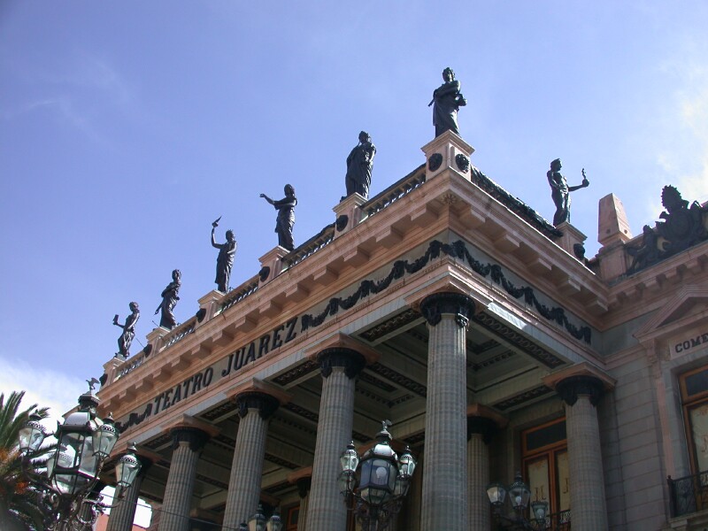
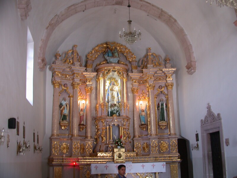
The very popular theatre in Guanajuato. Both San Miguel de Allende and Guanajuato have
many cultural events during the year. In October Guanajuato has nearly a month of events
that bring in the best from all over the world.!

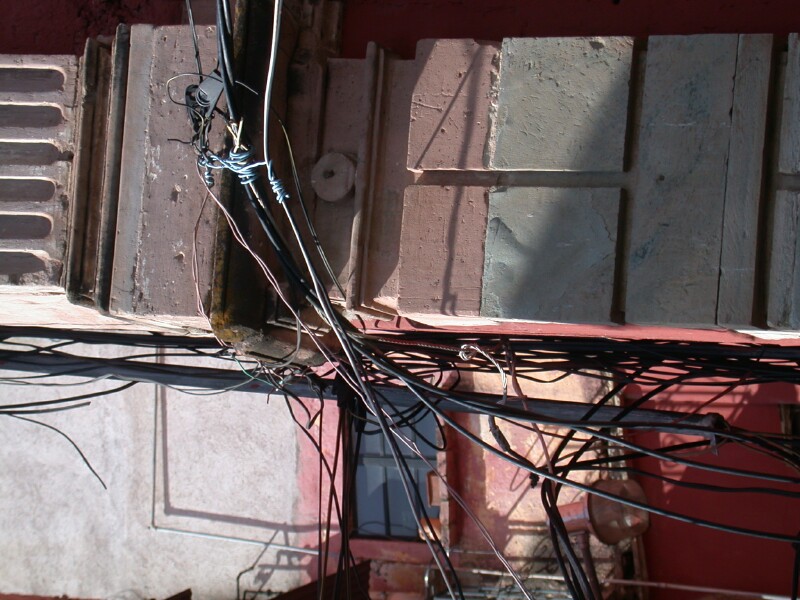
This is a picture of typical wiring in Mexico. Obviously they don't have a lot of
building codes.

Dolls in the market place in Guanajuato

Fruit and vegetables in the market in Guanajuato.

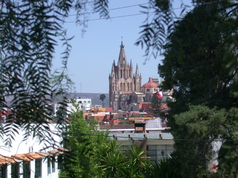
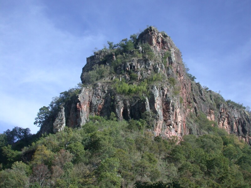
A picture of San Miguel de Allende from the El Mirador, look out.

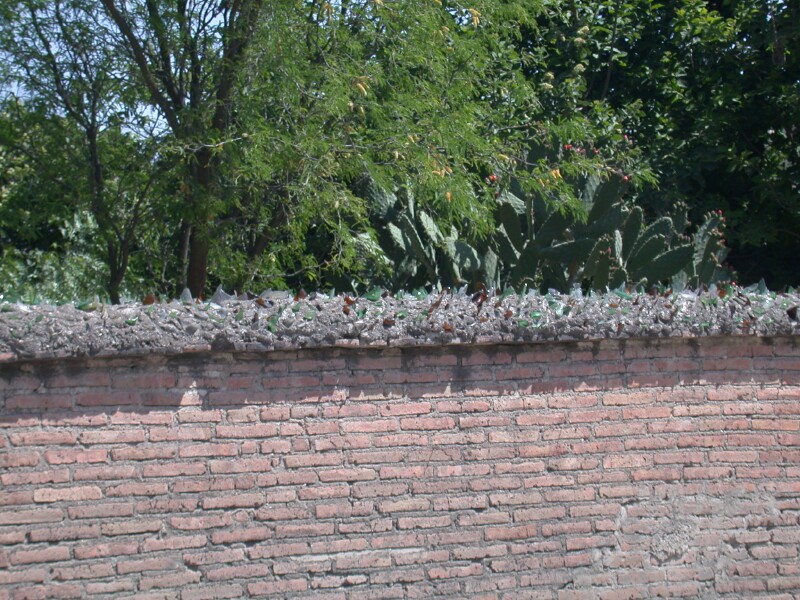
A very common site in Mexico was that most places are surrounded by walls and many of the
walls have had broken glass cemented in to add security. I really think it is more of a cultural
thing than an actual security problem as we heard of very little crime in Mexico. It is very
safe in Mexico and what you hear just is not true. Certainly there can be problems but I am
absolutely convinced it is much, much less than in the USA.

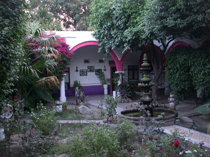
Another scene in San Miguel de Allende

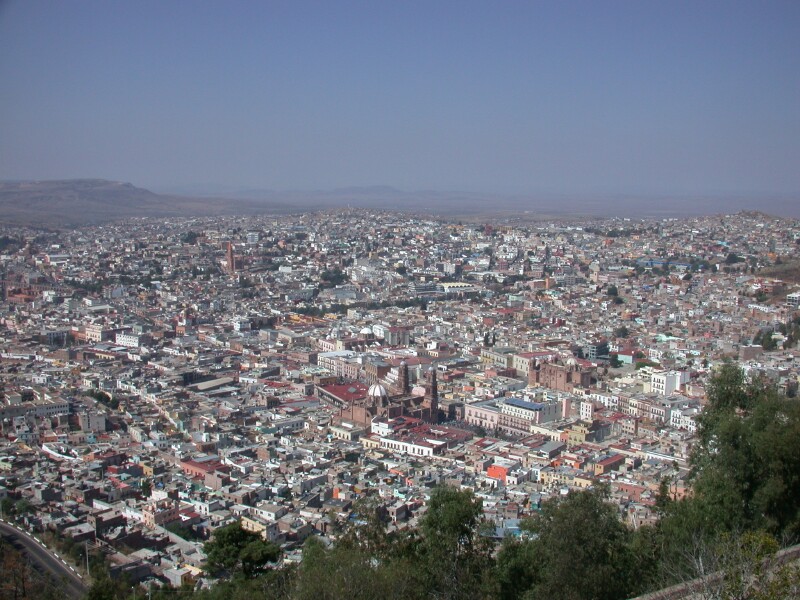
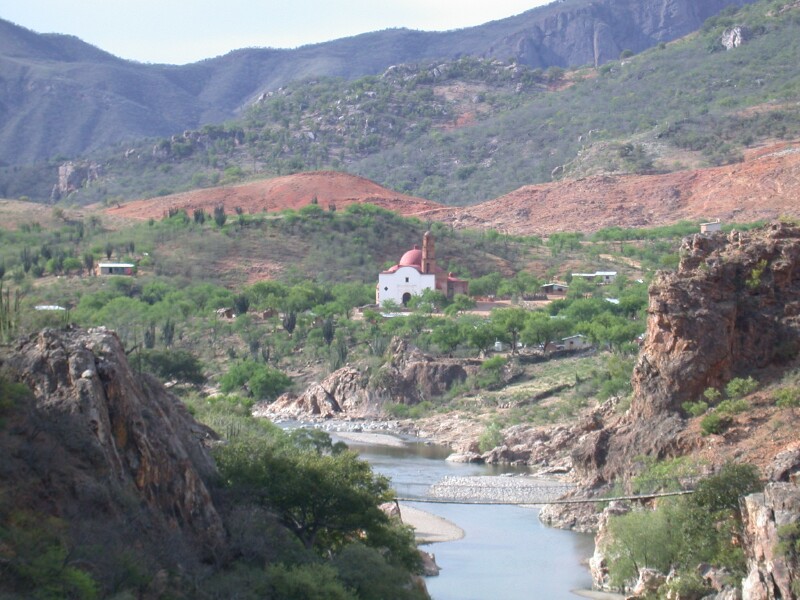
The chapel on top of the hill in Zacatecas a silver colonial town where silver is
still mined. Many feel the is one of the best colonial towns because it does not have
that many tourists and is a town that is clean and prosperous. We noted that the colonial
cities were much cleaner and also as we went north there were concentrated efforts being made
to educate and encourage people not to litter and to keep things clean and neat

A picture of Zacatecas

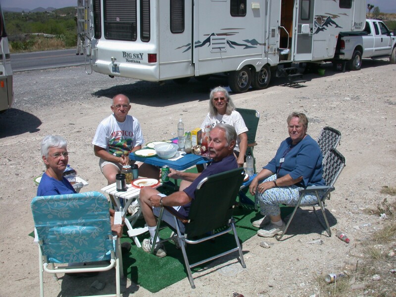
These were our travel partners Bruce and Eunice and Harold and Joyce. We had a great
time and traveled a few 1000 miles together. Since we had food that we could not take across
the border we decided to stop for a picnic lunch along the road between Zacatecas and Saltillo.
We were a popular attraction to the truckers going by as well as our fellow caravan rigs.

We left the Caravan at Saltillo just as it was getting light and headed for Chihuahua and
then Creel and the Copper Canyon. We made it to Chihuahua which was nearly 500 miles in one
day. We spent about $80 on tolls but we would of spent that much if we would of went with the
caravan back to Pharr, Tx and it really saved a lot of time. The campground at Chihuahua and
Creel were 2 of the top three in Mexico. Club Nautical by Veracruz was also very good! We
got to Creel about 11 am but found they were on Mountain time. That was a surprise as every
place else we had been was central time. We found we could still catch the Pacifico Copper
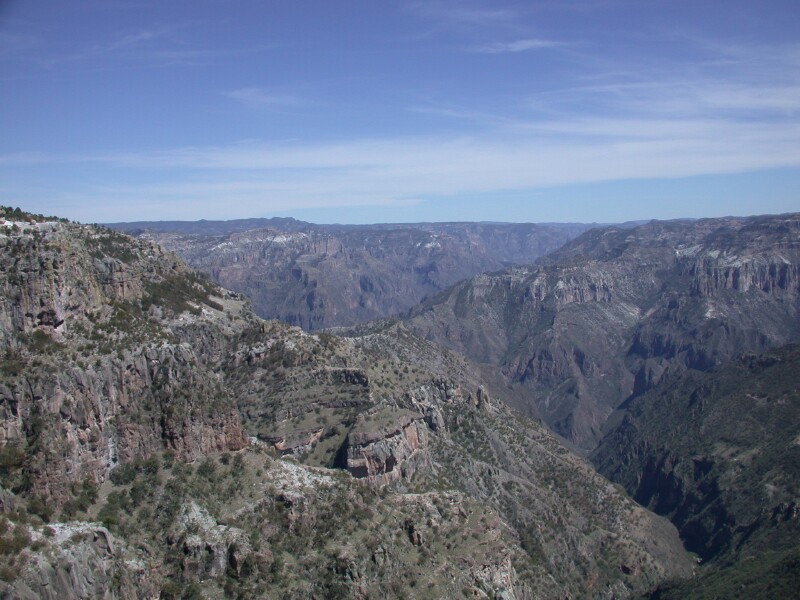
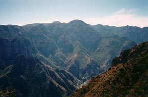
Canyon train to El Fuerte so we did. This is a picture of Copper Canyon at Divisadero which
is really the only good view of the deep parts of the canyon that you get on the train trip. We
missed the folks we met on the caravan. Each and everyone of the 36 other people were very nice.
No one was ever late for all our tours and in so many ways were great to be around, friendly,
informative and fun.

A view from the train. Other than getting off the train for 15 minutes at Divisadero the
most scenic part of the train ride is from Bahuichivo to about 1.5 hours out of El Fuerte.

The court yard at the San Francisco Hotel where we stayed in El Fuerte. A very historic
place. El Fuerte would be considered a colonial town.

The zocolo in El Fuerte at about 6 am.

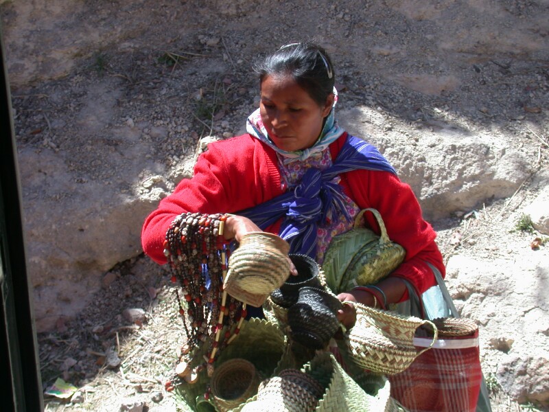
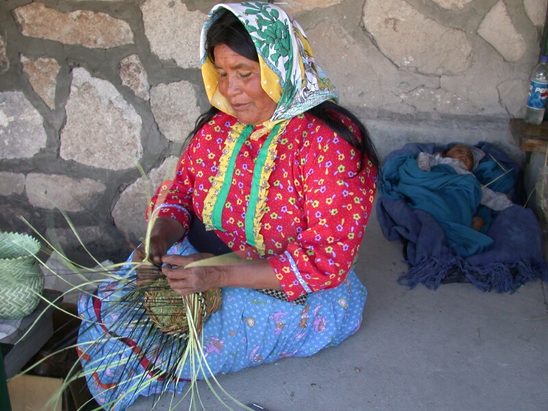
A Tarahumara Indian lady at Bahuichivo. Their baskets were amazingly beautiful and very
low cost. Their dresses were very colorful. I asked permission to
take the photo's but was unable to get one of a man. Their dress was also colorful and they had
bare legs but the shorts consisted of several folds of cloth. If you take a look at this URL
LinkClick on the picture to enlarge it and it will give you a better idea of what I am trying to
explain. What we seen looked a bit different but not much. These probably have a little
less cloth on top and on the shorts as they were running. When we seen them it was cold
out in the 40's

It is amazing how they make these baskets out of local native material. Even the litte
kids are making baskets. Many of the adults speak little Spanish but most of the kids can
speak Spanish as they are required to go to school

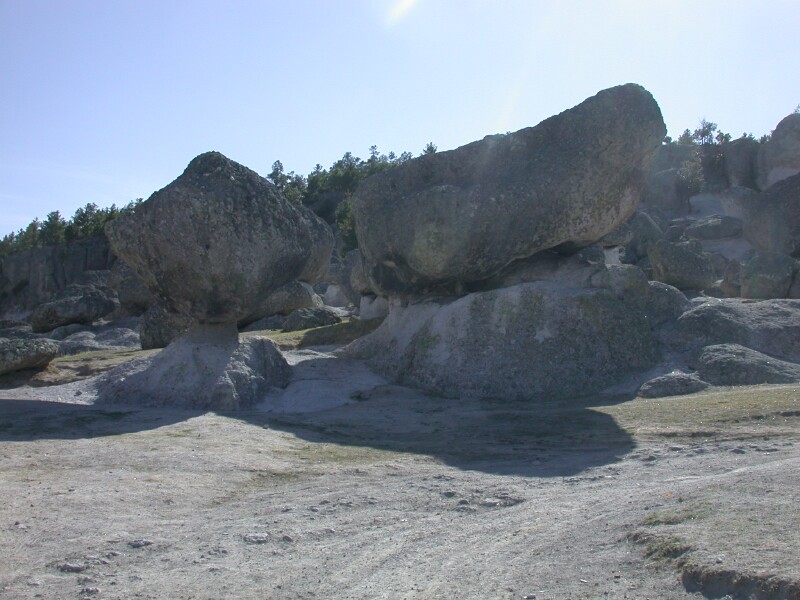
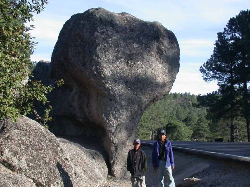
Mushroom Rocks a bit east of Creel on Tarahumara land. The road is pretty rocky and bumpy

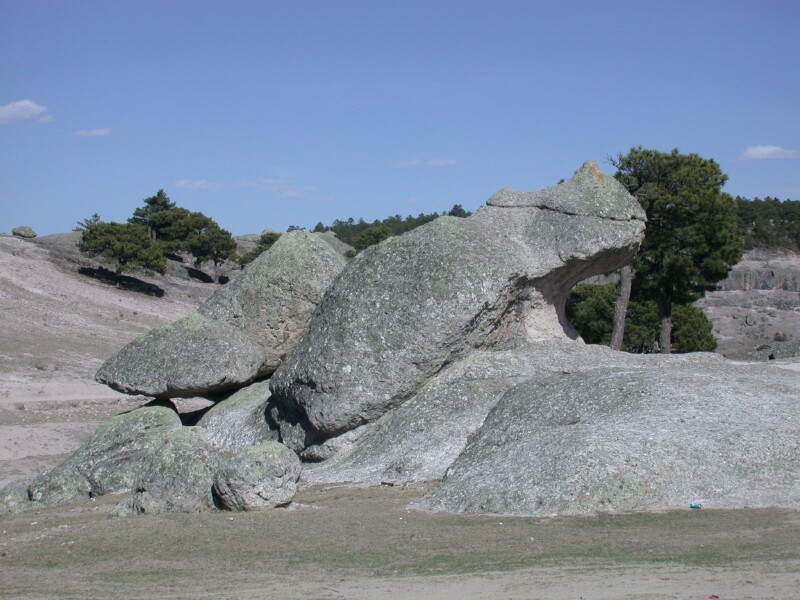
Frog Rocks nearby the Mushroom rocks by Creel on the Tarahumara land fairly close to the
Misson. There is a fee but it is reasonable

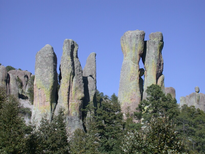
Valley of the Monks on Tarahumara Indian land. This is a fairly tough place to get to
and most people who go to Creel do not get here. It seems that unless you find someone quite
young your Spanish and certainly English just does not provide for any communication so it
is hard to get directions. We did have a map from the campground owner in creel that was
pretty good although not to scale. Really quite a remarkable place and well worth the drive
to see the Tarahumara Indians. You do have to pay a few more peso's at a final gate just before
you get to the Valley of the Monks. It is worth it as the view is much better and you can walk
up into the rocks

This shot was hard to get so is not the greatest quality but WOW! What a culture photo!
I don't understand the Tarahumara Indian culture to the extent I would like to but have done
quite a bit of reading on it. It was pretty amazing to see this type of dress, doing this
kind of work! If you want to do some searches using the key works Tarahumara Indians you will
find lots of good information. It is a very interesting tribe of Indians. Some are noted for
their long distance running.

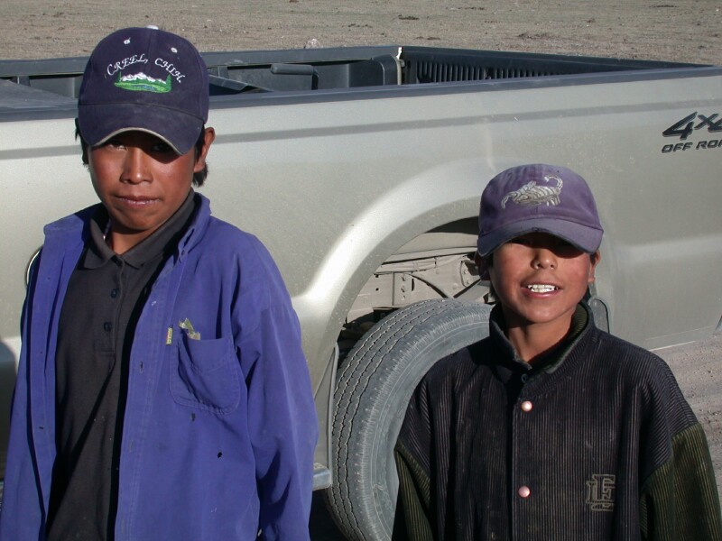
We were looking for Elephant rock and according to our map we were not quite sure. We
were drivng in an open area on Tarahumara Indian land and spotted these two boys. I stopped
and got out of the F-350 and walked toward them as they were walking to some houses in the
distance and they came over to meet me. I found out right away that they could speak Spanish
so we were able to communicate; although my Spanish is not real good. Anyway I find out they
are hungry and wanted something to eat. These two guys were absolutely a joy to be around. They
needed some money so they could eat. We had a policy of not giving to people begging as we think
it sends the wrong message but in this case I would of been happy to give them some money. Anyway
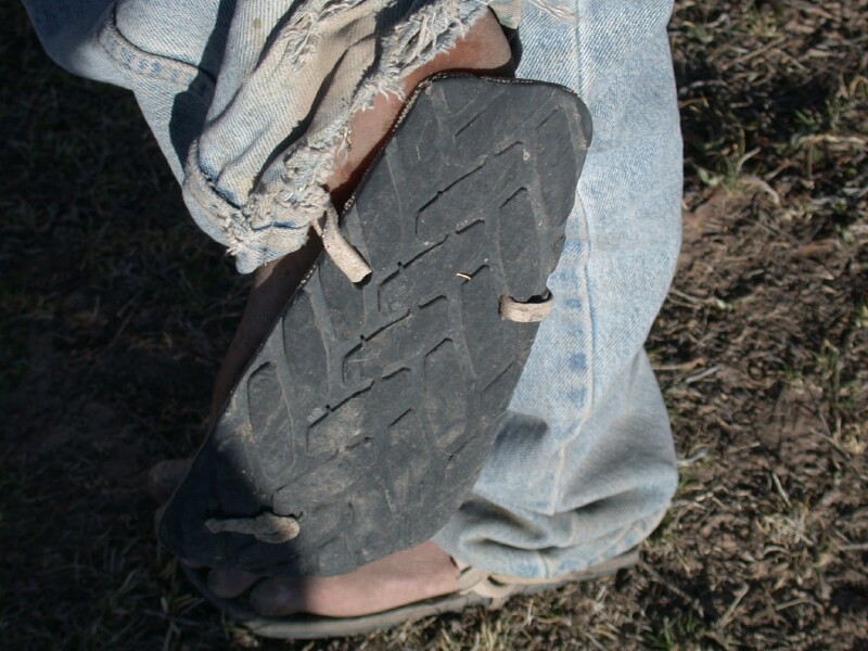
I had a better solution. I would pay them to take a picture of their shoes which are a "CLASSIC"
of Tarahumara Indians. They a are made out of rubber tires and nearly all of them wear them and
run in them when not going barefoot.

Here are the boys that we then hired to guide us to Elephant and Turtle rocks.
The guided us right to them! They then wanted a ride into town so they could eat with the money
we paid them so we gave them a ride into Creel. I grilled them but good if it was OK with their
parents and if they could get home OK. They assured me they could. I dropped them off in Creel
and watched them as they went down the street and into an eating place to get some food. These
guys had million dollar smiles and as they left me from the truck in Creel they were grinning from
ear to ear and telling me in Spanish that they were going to get something to eat!!! I will
never forget these guys!

Elephant Rock is actually right along the main road and not on Tarahumara land and we
had been by it earlier but did not notice it. The boys took us right to it! I was wondering if
we were communicating when they took us off the Tarahumara land and out on the highway but they
did understand. They then took us on down the road just a bit to the Turtle rocks. In true
Mexican fashion we paid the boys for services rendered based on the prior agreement.

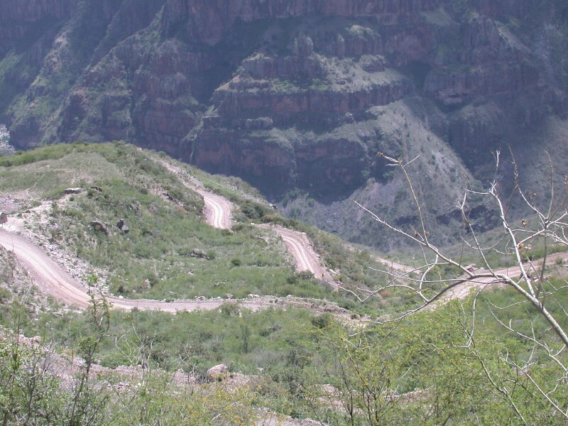
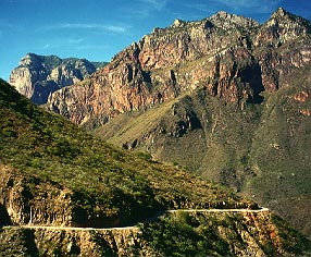
This is a view of the road down into Batopilas Canyon to Batopilas. It is about a 5 hour
bus ride from Creel and a little less than 100 miles. The last 40 miles is gravel. Pictures do not do this justice. It is like driving down into the Grand
Canyon in AZ. There are countless switchbacks to get to the bottom and the road hangs on the
cliff and is one way. If you meet someone on a corner it is very exciting. One of the vehicles
has to back up to a wider spot and you can then just barely squeeze by. Batopilas is pronounced
BAT O PE las with A being an AH sound and I being E like eagle.
Another photo of Batopilas Canyon, don't have a bigger picture this is it.
Another photo of Batopilas Canyon, I don't have a bigger picture this is it

Scenery from down in Batopilas Canyon on the way to the town of Batopilas.

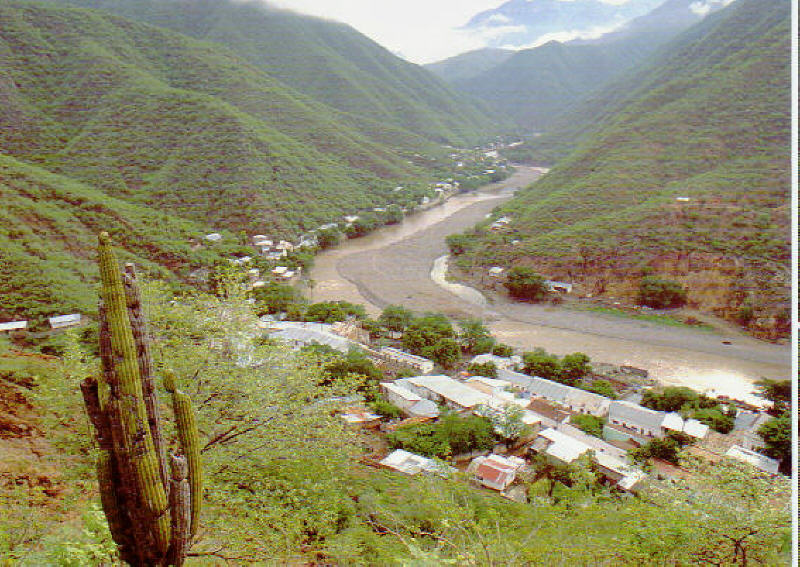
A picture looking down on Batopilas which is along the Rio Batopilas.It is an old mining
town

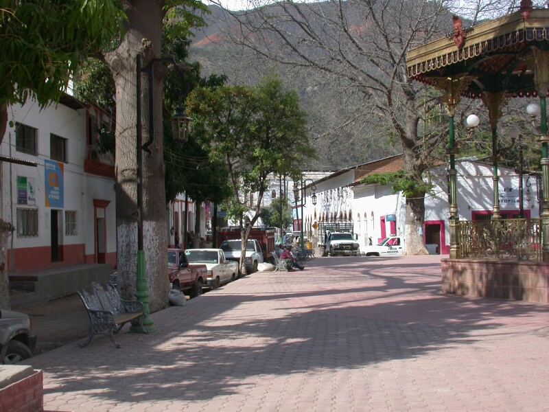
The zocolo at Batopilas, they were getting ready for the week long celebration for Easter
when the town fills up with people from all over the world.

Hotel Mary which is a very nice reasonably priced place to stay and where the public
bus arrives and leaves from but it was full so we stayed at a Hostel and met Rene and Rachel two
young backpackers. We did several things together and really appreciated them. Rene was from
Mexico and could speak good English and Rachel was from Australia and Tasmania. Hopefully they
will come visit us in South Dakota. We have their E-mail addresses and can keep in touch

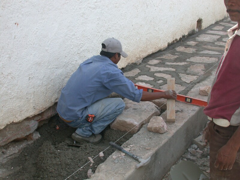
Working on the walkway by the zocolo in Batopilas.

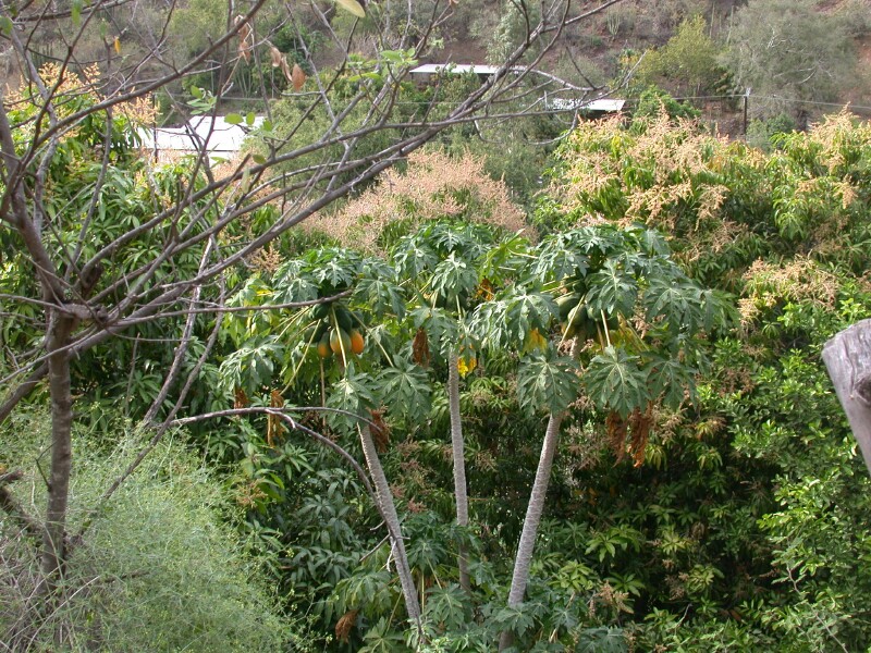
You can see the tropical nature of Batopilas. It is less than 500 meters above sea level. It
was late March and getting very warm already. On the canyon rim on the way out we seen snow
which is about the only place in Mexico where you can see snow. At Creel it froze at night but
got into the 60's in the daytime. Obviously there is a big contrast in climate from Batopilas
and the top of the canyon

The Shepherd Hacienda where all the silver was processed and shipped out in the late 1800's
and very early 1900's. You can see our friends Rene, Rachel and also a guide who live in this
area and the USA. He was with a brother and sister from Ohio who was guided by him and another
guide from Urique to Batopilas on a horse back ride. If you want to hike or ride in the Copper
Canyon a great way to do it is to get off the train at Bahuichivo and take a van down to Urique
and then hire a guide over to Batopilas. From there you can take the bus to Creel and take the train
on out. Likely a 2 or 3 day ride or longer if hiking. The reverse would be to come to Creel, take
the bus to Batopilas, hike or ride to Urique, take the van to the train and out. You can take
the second class train as it is cheaper. You can also also come and leave from El Fuerte rather
than Creel or Chihuahua.

The so called lost chuch about 4 miles south of Creel. It was a hot hike on the way
back but the road is good. You can hire a ride if you don't want to hike.

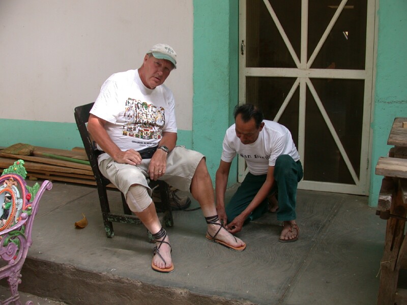
Being fitted with my Tarahumara Indian sandels at a shop at the second zocolo in Batopilas.
His wife cooked a couple of meal for us.

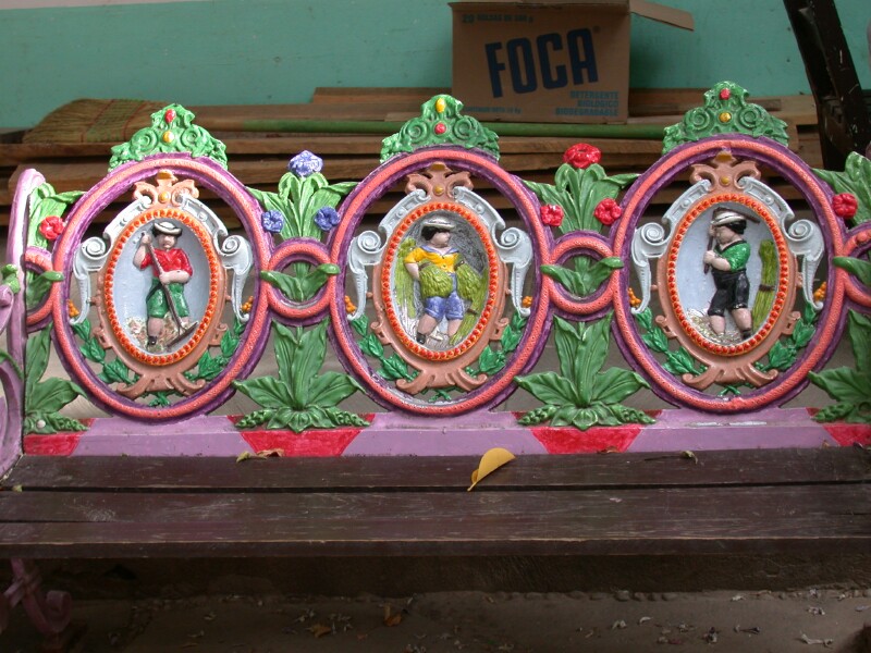
Very colorful and unusual benches at the Zocolo in Batopilas.

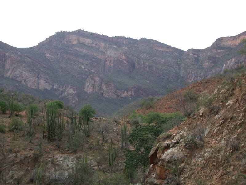
A picture from a hike I took with a Mexican friend into the mountains by Botapilas. It
was quite an adventure you can read about in the traveloges. We had a guide
and it was a good thing as we would not of made it back before dark without him. If it is your
first time in the area and you do not have GPS way points I would recommend a guide as the
maps are not that good and the trails are confusing and not marked. A guide is not very costly
and until you know the route and have GPS way points, things written on the map and notes about
the trails is just is not smart to go on your own. Also there are areas where "POT" is grown
illegally and they don't like intruders so you don't want to stumble into these areas.

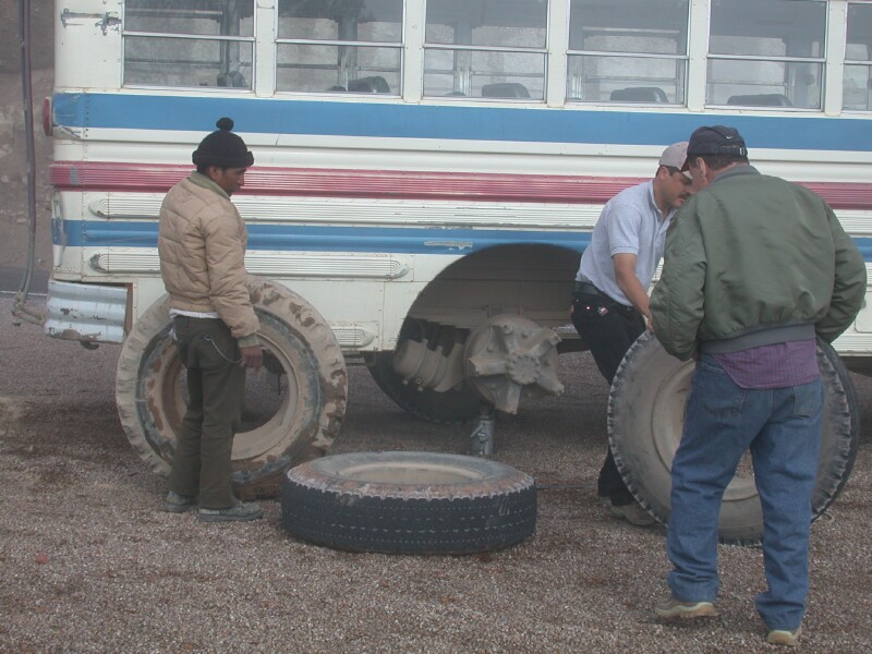
The rough road out of Batopilas Canyon had its toll as we had a flat on the inside
dual of the bus. We headed back to Creel and then to La Junta which took us out of the mountains
and trees to the plains. At Cuauhtemoc the mennonites settled many years ago and there are fruit orchids
and cheese plants. The state of Chihuahua is very progressive and have made many improvement. We
entered the USA at Progresso, Tx and again my Spanish help immensely in getting our vehicle permit
turned back in and getting a reciept. I want to emphasize Mexico is safe! Things are improving
and changing in Mexico. There is still a long ways to go but things are on the move. The
thing we noticed about the USA was the better roads and of course the abundance of high quality
food and the roads being safe to drive at on night.
link to To Main Retirement page of Ed and Edith