2002 SUMMER Trip to the Maritime Provinces of Canada and New England states PART I
This was a 88 day trip and we traveled 15664 miles. We left in June and got back in mid-September.
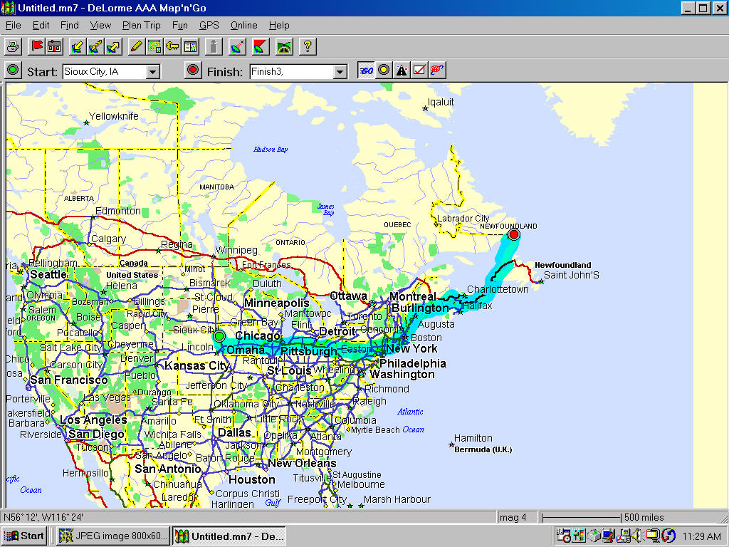
I have put pictures of maps on the web pages showing the approximate route of the different legs
of the trip.
If you read the dailyTRAVELOGUE you will get a lot more details about the trip. The travelogues
are unedited as I want to enjoy my retirement and really don't want to invest the time to edit
them so you get them as is personal notes and all!
Also there is a link to the E-MAILSthat we sent out while traveling. There is of course some
duplication but a lot of it is not.
As you go through the pictures and captions and refer to the travelogue and E-mails you can find
out a lot about what we saw and did on the trip. This should not be to hard to do since the
travelogue is in order by date and the pictures are in order as well. You will of course find days
where there are no pictures posted but there is always a travelogue!

This shows the aproximate route for the first leg of our journey to St. Paul Island for our amateur
operation and then on to the north tip of Newfoundland and via ferry to the coast of Labrador.
One other note of interest is that we did not see a SD vehicle on the whole trip in Canada and New England other that I believe
I met a pickup with SD plates at Cape Spear Newfoundland but it may of been an RVer that just licensed
their vehicle in SD. We did finally see our first one that definitely was from SD in Michigan and then
three in Minnesota.

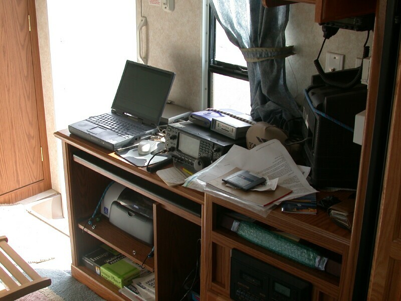
This is the amateur radio equipment along with the laptop mounted in the 5th wheel for sending and recieving E-mail
via amateur radio and for making radio contacts with our friends while on the road.

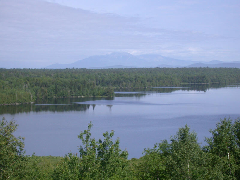
Here is a picture north of Bangor, ME of Mt Kathadin which is the highest mountain in Maine.
We don't have many picture on the way out but suffice to say from eastern Ohio on it is pretty much
trees and is quite hilly. Once you get toward NY and on to Maine there are lots of traffic. There
are plenty of pictures of New England and the Maritime provinces as well as Quebec and Ontario that
are one these pages taken as we worked our way back west.

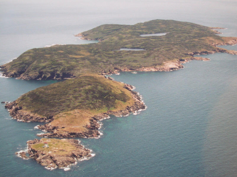
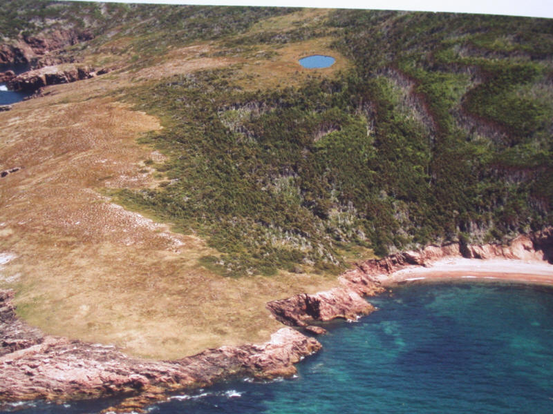
Here is an aerial photo of St. Paul Island taken by Billy Budge VE1AAO who was our local contact for
the trip and who without it never would of happened. Billy grew up on the island with his dad and mother.
His dad was the light house keeper on the south end of the island. St. Paul Island is located north of Cape Britton
out of St. Lawrence Bay about 15 miles. It is located in the Cabot Strait between Cape Britton
and Newfoundland.
The major part of the first leg was to a small island called St. Paul Island for an amateur radio operation. This counts as a country
in amateur radio and was ranked the 75th most rare country in the world out of about 320 for amateurs to make contact with.
It is rare because you can only land on it in the summer and the sea's are typically very rough and there
are only a couple of small rocky beaches. The island has a high cliff all the way around it. There is also a lot of difficulty
in getting a permit from the Canadian Coast Guard to legally land on the island and they require over
a million dollars of libility insurance. No one lives on the island and the structures on the island are
in very bad condition and the Coast Guard does not allow you to get close to them. This means we had
to bring everything and stay in tents and leave things as we found them or be fined. If you are interested in this in
more detail there is a link to amateur radio trips I have been on which has some more St. Paul
pictures and you can also do a search for WV2B Duane's St. Paul Sites. Duane was with us to
the island and has been on other trips to the island

Again an aerial view taken by Billy Budge VE1AAO. This is the what is called Petries Point and
is where we operated from. From the aerial photo if the seas are calm it does not look to tough,
well guess again. There is about a 30 foot cliff off the rocky beach and then some very tangled
bushes and trees to get through and then a long, long carry of hundreds of pounds of equipment with
black flies chewing on you all the time.

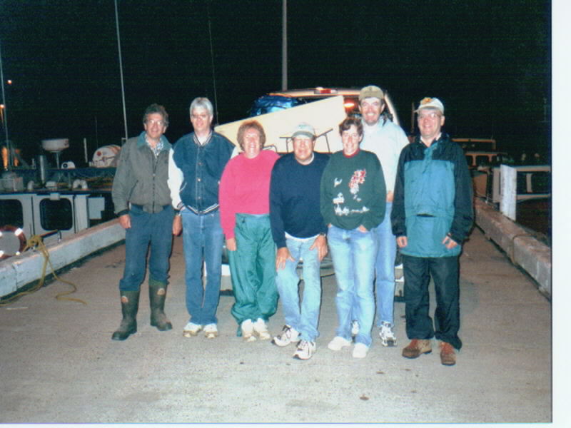
This is the group of amateur radio operators who went and operated from St. Paul Island.
Left to right are Billy Budge VE1AAO, Duane Traver WV2B, Edith Gray W0OE, Ed Gray W0SD, Holly Thompson
N0QJM, Arliss Thompson W7XU, Jim wade VE9DH. The picture quality is not the best but it was 3 a.m. and
foggy on the dock but it is the only picture we have of all the complete group.

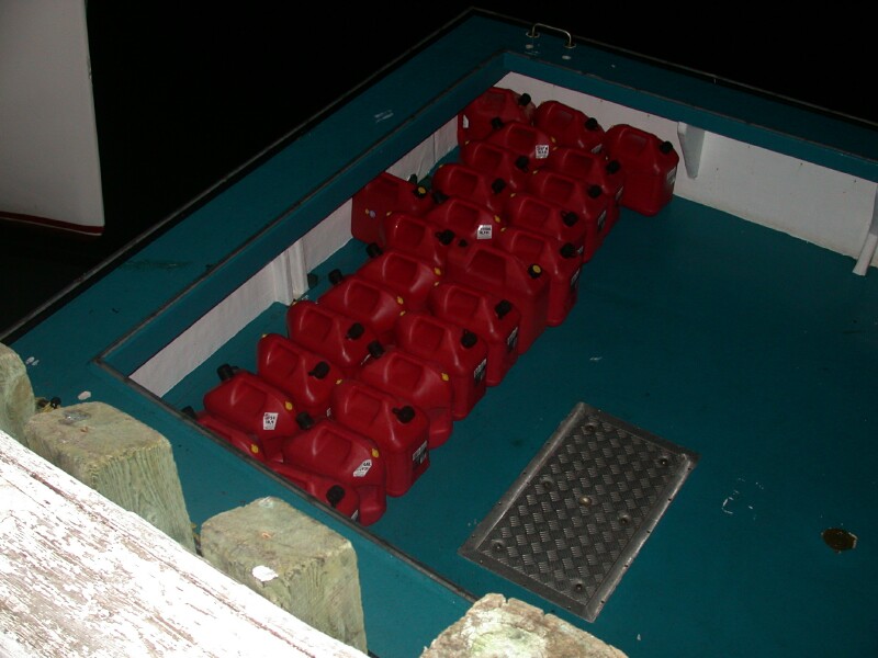
We arrived at the dock at about 3 am and started loading the boat. We had my F-350 full, Holly
had driven out with the Expedition and the back of it was full plus the generator on the receiver
hitch and one of the group had their car trunk full. The pictures we got of the loading are not
very good because of a flash not being very effective at 3 am in such a big, open area. Here is
one good picture of all the gas we brought for the generators. Those are 5 gallon plastic gas
containers!

Edith at about 4 am on the way to St. Paul Island. It is chilly but our Captain Robert
can not believe how calm the seas are. I told him I had been believing the Lord for calm seas for months

Our Captain, who is a lobster fisherman comes to the island everyday during lobster season,
gave us a tour around this island while we are waiting for it to get light enough to land. This is a
beautiful sunrise looking back to the east toward the small north island. The light house
is automated but no one is permited on the north island. The south island where we are going
is by permit only.

Here is our boat the GrayhoundI with Arliss and Bill on the beach with the dingy which
leaked badly! The have tied a rope from the boat to a big log on the beach to help hold the boat
and then have set up a rope on the dingy on each end so we can pull it back and forth with
equipment loaded off the boat into the dingy. With the calm seas all goes well except someone
has to be in the dingy bailing all the time and about every 3rd load we had to tip the dingy
over to get some of the water out of it. Fortunately everything was packed in dry bags and the
bigger pieces of radio gear were in boxes which we kept up on the seat. The dry bags would resist water but likely would not of handled
submersion.

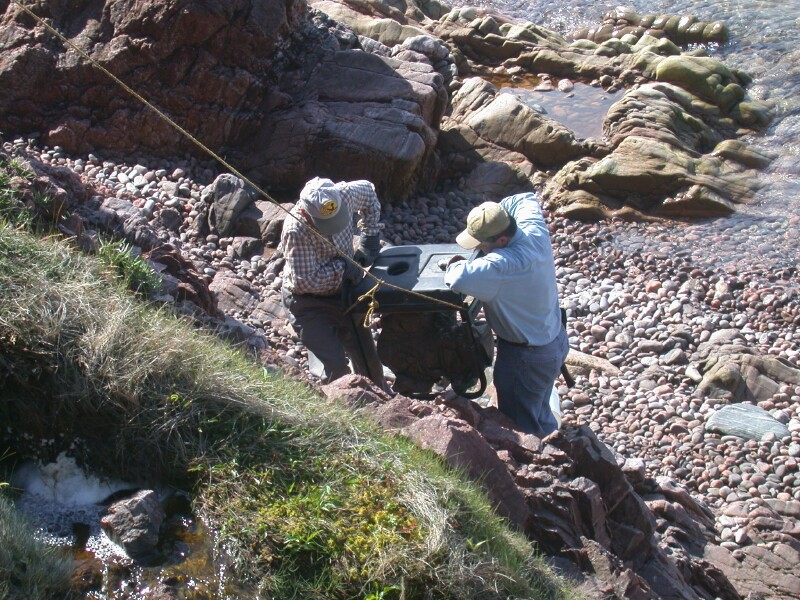
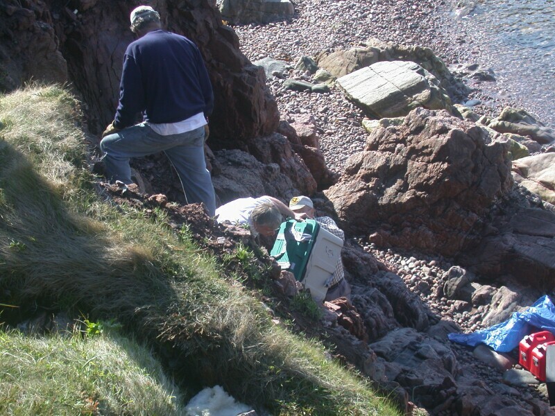
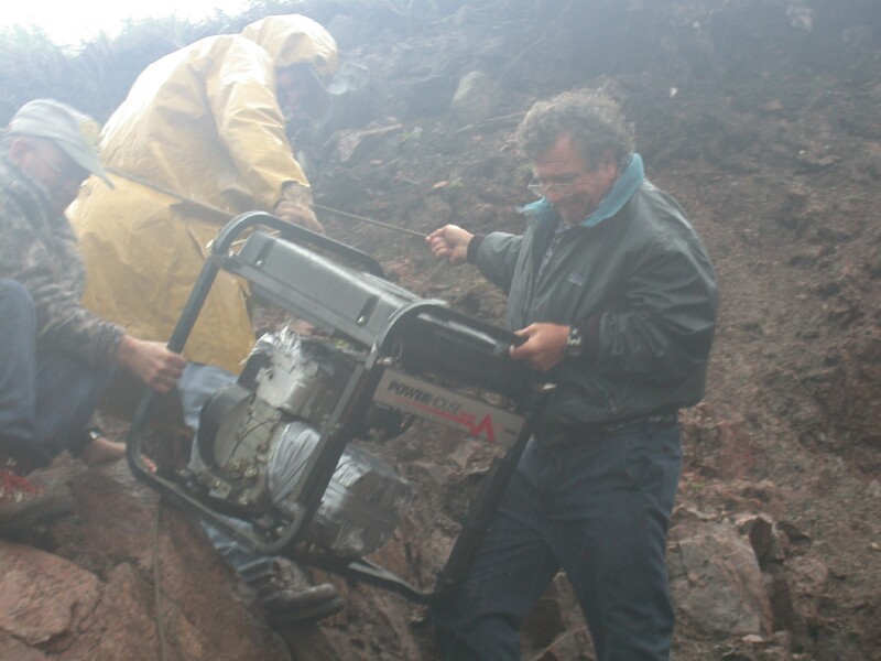
Now the hard work begins. Here are Jim and Arliss lifting the generator up the cliff. I am
on top of the 30 foot cliff pulling with a rope. It was so steep a lot of places you could not stand
safely so you had to hold on to another rope that was anchored at the top of the cliff and hung
down the side.

Rope to keep it from falling back down and to hold the weight while the
crew got a new foothold to lift to the next point.

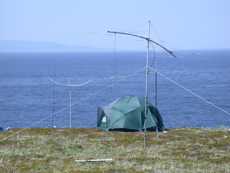
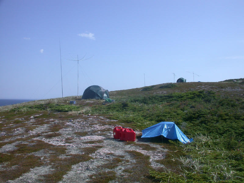
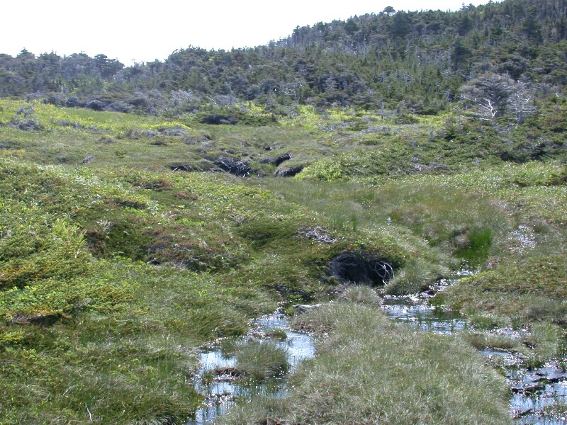
Here is the VHF operating tent

In the foreground is the HF operating tent where 12,000 contacts were made. You can see the both operating
sites and note the color in the tundra

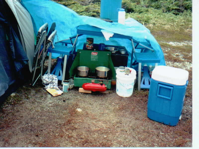
Edith's cook tent, often there was a lot of wind

Because of weight considerations we only took 5 gallons of water to the island. The first water
we used we ran through a filter and boiled but it had a lot of plant coloration in it so looked pretty
gross! We then found this stream and it looked and tasted great. It was about 1/4 mile hike
but was well worth it. We of course boiled it.

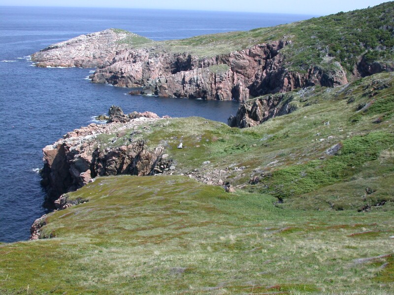
This is looking northeast of our operating site at what is called Goats Point. Most of the
scernery pictures were taken on the two bright, sunny days. The rest of the time it was cloudy,
windy and rainy or foggy.

We got word over the radio that our boat Captain said we needed to come off a day early as
the following day the wind was forecast to be westerly and would come right on our landing beach and
might make it impossible or very difficult to get our gear loaded. The weather deteriated as we
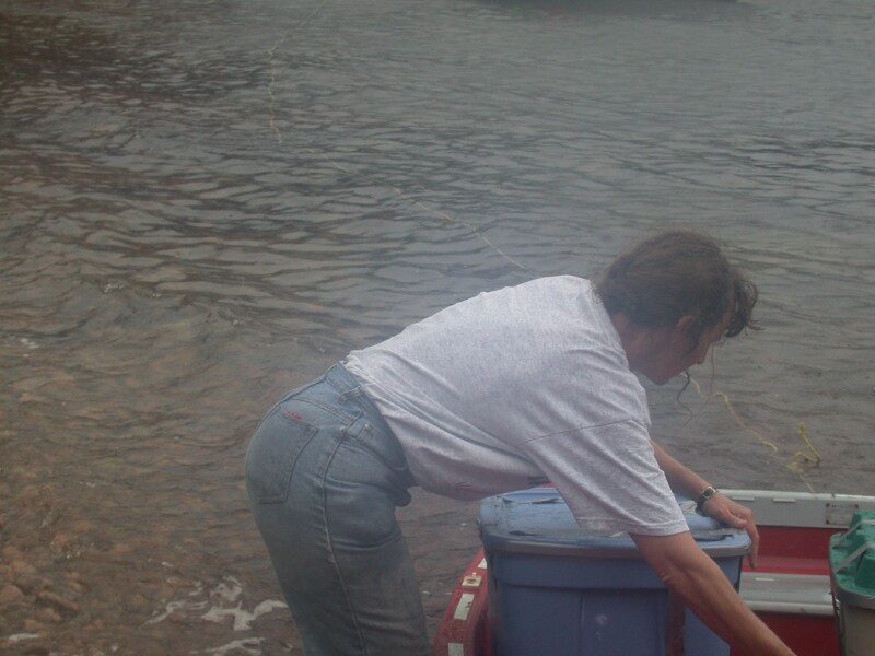
were hauling things to the beach. It never got windy but it really started to rain! This is Holly
N0QJM working hard. She got soaked! Her and Edith worked very hard under miserable conditions.

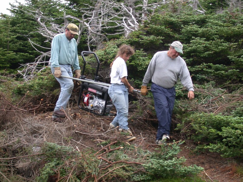
This was earlier than the previous picture before the rain started. The generator weighed
about 100 #. The carrying handles were a life saver. It was about 3/8 of a mile haul.

This is Jim, Arliss and Bill working the generator down the cliff. I am up above holding as
hard as I can on a rope hooked to the generator. I think I had the best job!

They brought out a different dingy. It still leaked but not as bad as the one which we
landed on the island with. Jim had patched the old one which they left with us. We may have been
better off using it.

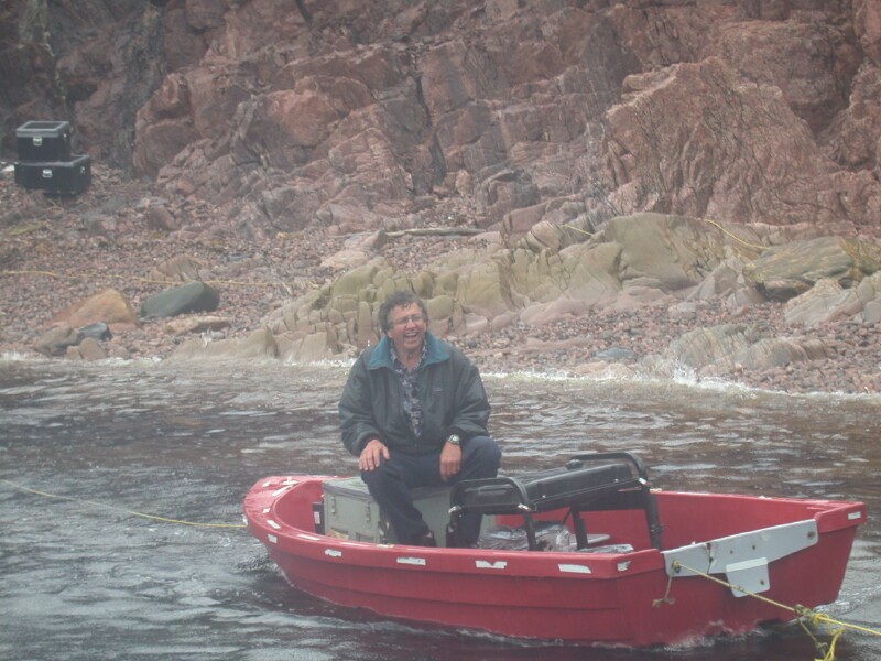
This is a picture Edith got of me coming off the island out to the big boat. At this point
everything is safely loaded on the big boat and I know that months of planning and the last several
days of exhausting work has paid off with over 12,000 contacts and no injuries or other problems. I
had no idea she took the picture and was amazed when I seen it for the first time. I know I had
a feeling of thankfulness and satisfaction but the picture says IT ALL!

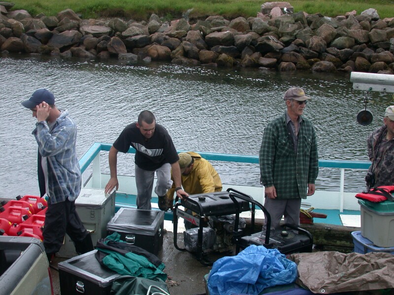
The crew and a bit of our gear unloaded at Bay of Saint Lawrence. Our Captain Robert is
in the center in the plaid shirt

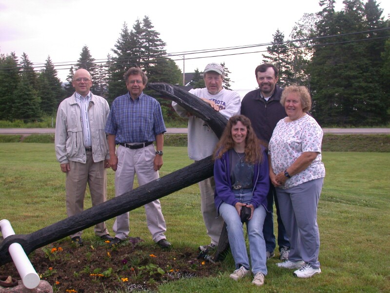
This is the crew minus Duane WV2B who had to leave after 3 days on the island. Left to right
are Jim Wade-VE9DH, Billy Budge-VE1AAO, Ed Gray-W0SD, Holly Thompson-N0QJM, Arliss Thompson-W7XU
and Edith Gray-W0OE.
Link to To continue Part II